

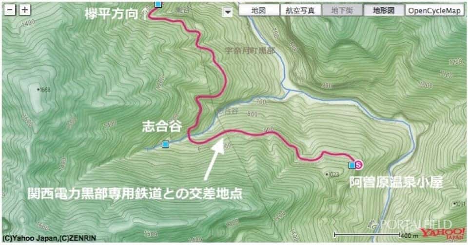
2016 lower corridor, horizontal sidewalk route. XNUM / XNUM Azohara Onsen Goya → Kotohira → Toyama Hen XNUM X
The journey of the day:Azohara Onsen Goya→ Oriodani Sabo embankment tunnel → Shiaitani tunnel → Kotohira → Unazuki → Toyama → Tokyo
Section introduced on this page: Taiko drum → Shigaya tunnel → Kabuya → Sugadaira
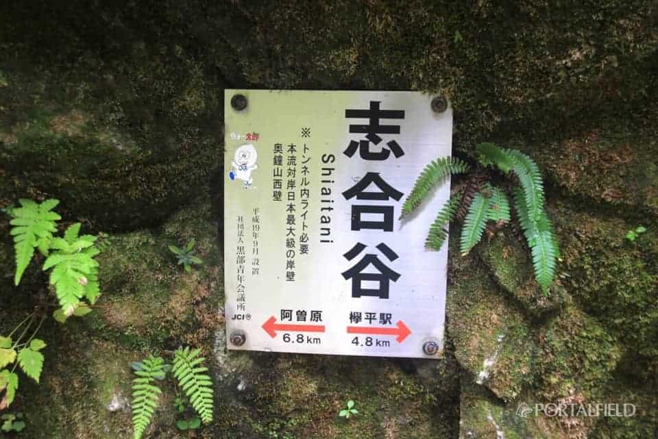
The longest tunnel in the lower corridor to Shiai Valley
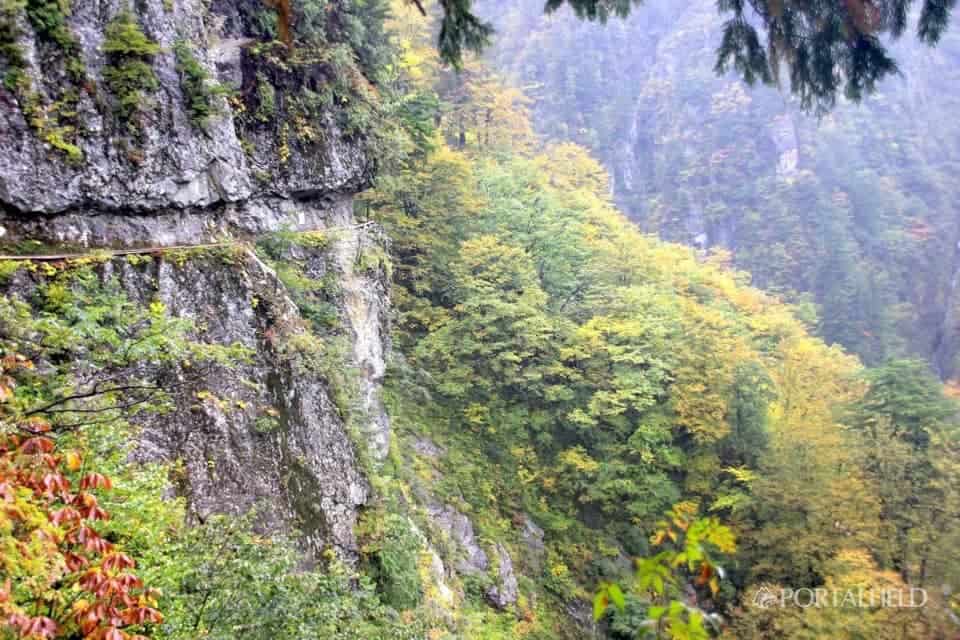
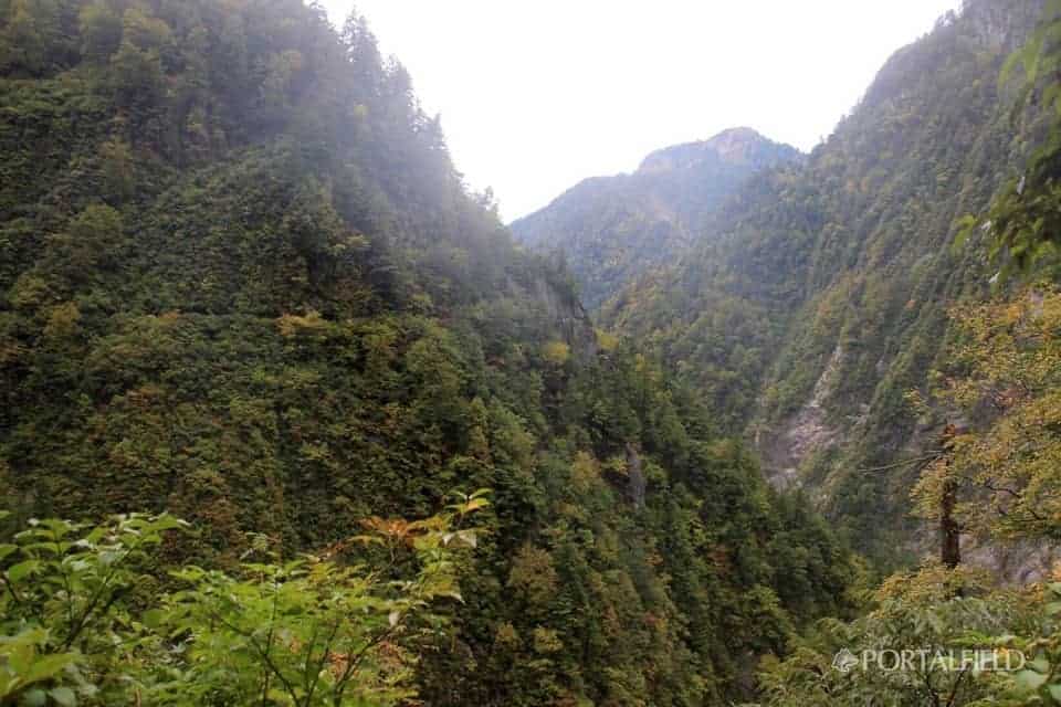
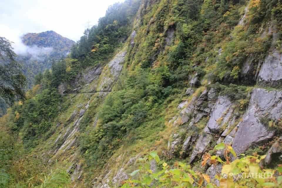
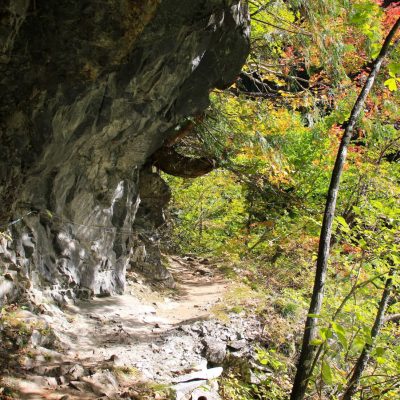
Depart from the high drum with a sense of altitude, and the next pointShiaiyaHead for The horizontal sidewalk maintains an almost constant height in this area, and across the Kurobe RiverWest wall of OkugengshanI want to go ahead. As the route is routed according to the shape of the mountain, when you get close to the valley, you will see the opposite horizontal footpath across the valley, and you will continue to make it to Kohei.
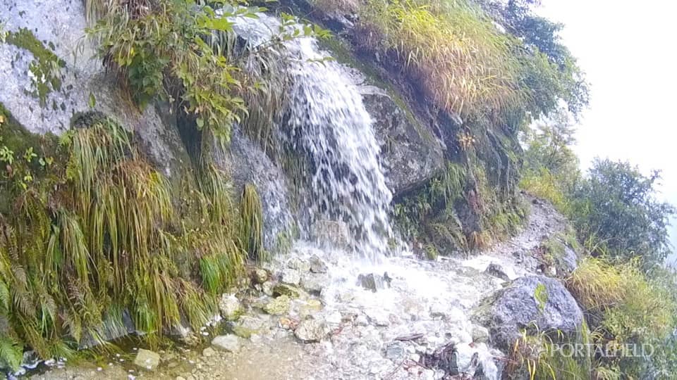
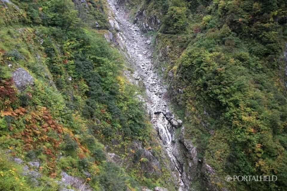
As I walked from the drum, I heard a loud water sound about 30 minutes. I came, todayWaterfall line location 3. It is scary to get used to it, and once the waterfall continues, it loses its freshness like the first time, but here the width of the flow is good, the amount of water is good, and it is no less comparable to the waterfall we have seen so far is. If this continues, somethingI calmly observe the scale of the waterfall or myselfThere was (laugh) State of passage is this (※ sound comes out)
2016 lower corridor, horizontal sidewalk 10 moon 17 day waterfall line 3 from Koheii on Vimeo.
On this day, for the first time in the XNUM X waterfallPass almost without getting wetIt was possible. It's raining, so in practiceThere is not much difference between getting wet and not getting wet(Laughs) I think that you can pass while avoiding the waterfall because the road is a little wider here.
Where are the lodgings in Shiaitani?
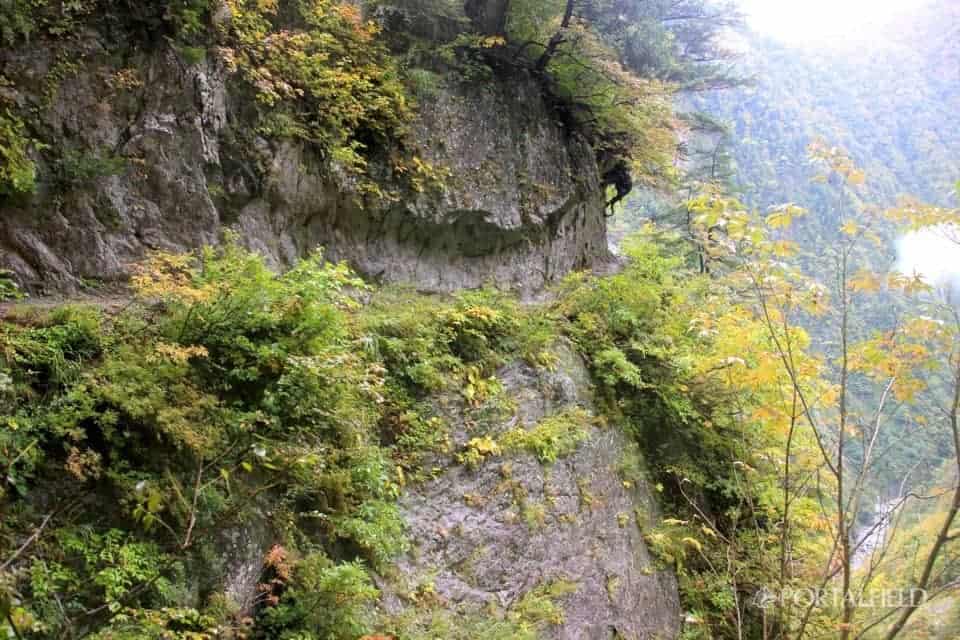
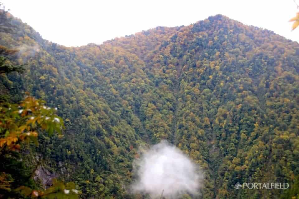
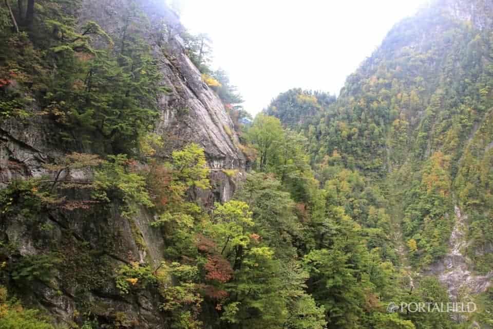
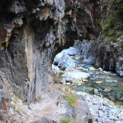
Soon after the waterfall line 3, the gas became a little thinner, and it was in between Shiai-dani. The horizontal footpath on the opposite side was on the left, and the rock wall of Okuganeyama on the right. It's the place of this picture, but maybe it is.
It is not a story that is limited to this time, but I took it when writing an articleShooting time of photos and videos,GPSlogBased on theIdentify the place to some extentOnCombine my memoriesI'm writing an article, but when I checked this photo and checked the shooting location, it was remembered that there was something.
"XNUM X Moon X NUM X hen-X NUM X S-Gray → Senjindani Dam → Azohara Onsen Goya"In the henSenjindani DamEven when walkingAkira Yoshimura's novel "Tatsumi Sakai"I made an article about the contents of, but it will come out at that timeOrbital tunnelthere is. CurrentlyKansai Electric Power Kurobe RailwayHowever, this railway goes straight underground deep in the area where there is a horizontal footpath. I can see it by looking at the map,
ち ょ う どRight below this areaIt feels like the tunnel is crossing. Some people may have noticed that, butKurobe third power plantAlthough it was built as a lodging for workers who will work during construction,Bubble AvalancheMany victims were killed byShiaiya lodge ruins, It should be just under the route you are walking now.

At that time, in a bubbling avalancheRebar five storiesThe part from the second floor to the fifth floor of the dormitory of the whole remains the formBlown awayOh, it goes over Shiaitani,Catastrophe hit the rock wall of OkuganyamaEnglish learning is necessary to prepare for life, learning and interaction with the global environment. <br> IT Skills (programming logic) is necessary to prepare for the needs of the future.<br> Financial literacy is necessary to prepare for creating, managing and being smart with time and wealth.<br>
As an overview image, it seems that it might be that it jumped over the slope in front of the eyes from the foot side of the previous picture and hit the rock wall in the back. This is a novel "High fever"Also comes out in detail.
If you go over the Shiaitani tunnel and go to the opposite side, you may see the Shiaitani dorm. But when walkingI was not conscious of that at allBecause I could not take a picture.
ShiaiyaHas been seen. It was a pretty deep valley and I could not see it this year due to low snow,YukieSeems to be left behind.
I also walk around the area where I was drawn in a U-shape. It looks close in the picture, but it is about 10 minutes from the place just before Shiyadani tunnel entrance. There is a distance than I thought.
Arrive at Shiai Valley
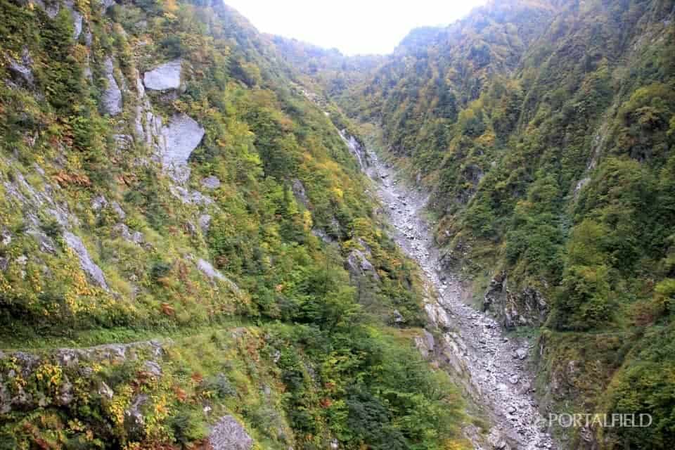
Looking at this photo, the height of the back ridge may not be that muchSomehow peaceLooks like a nice photo, but below the horizontal footpath not seen is a cliff.
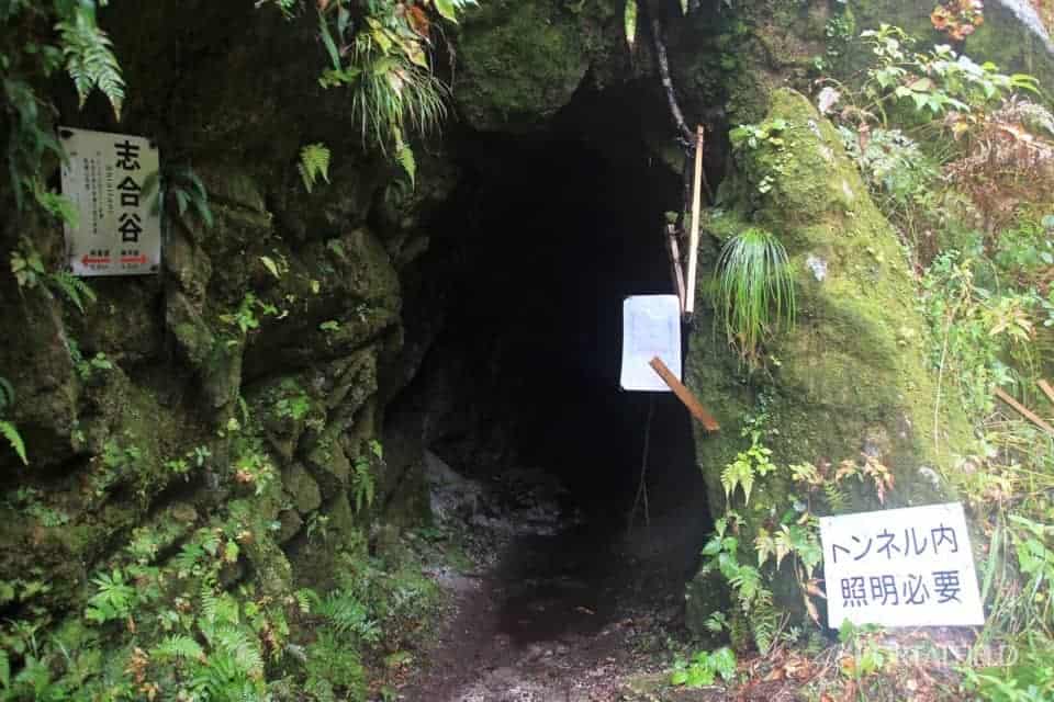
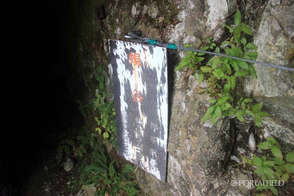
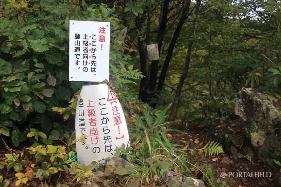
8: Around 00,Shiyadani tunnel entranceI came to
According to the "Yama-To-Kogen-Chizu" map "XNUM Xm tunnel""Foot flow""Flashlight waterproof required"And.
This time at the mountain line in the lower corridorOne of the things I was worried aboutWas this tunnel. As foot flow water is good, waterproof measures are necessary, and this is vague at all. Is the stream soaking in your shoes, or is it just getting wet? You should take off your shoes and walk.At first I was seriously considering taking sandals(Laughs) I wondered if I put plastic bags on my shoes, and so on, but I wonder if it will be. I went without doing special measures.
By the way, here,It's not like an open space, and the road width is not particularly wide.So you may take a little care to take off your shoes and put on your sandals, or arrange your luggage. It becomes the point of the map,It is not an atmosphere that you can take a break.
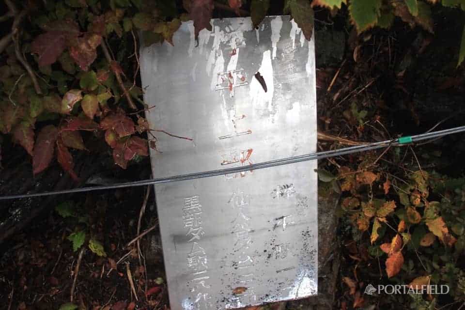
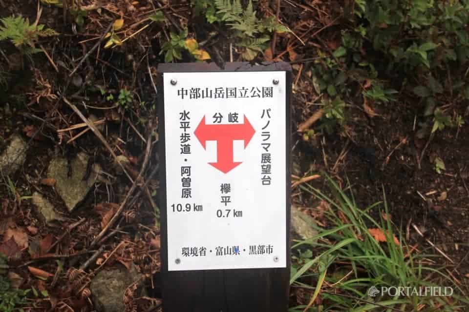
I have walked quite a bit from Ashihara, but there is also a lot of 4.8 km up to Kohei. In the lower corridor, this signboard is displayed at every point through the old Nichido sidewalk and the horizontal sidewalk.2 typeThere is. One was often seen on the old Nichido trailObviously the old type, Like this pictureNew typeIs a feeling from a large drum. Still, "War TaroWho is it? It has always been a mystery (laughs)
About War Taro
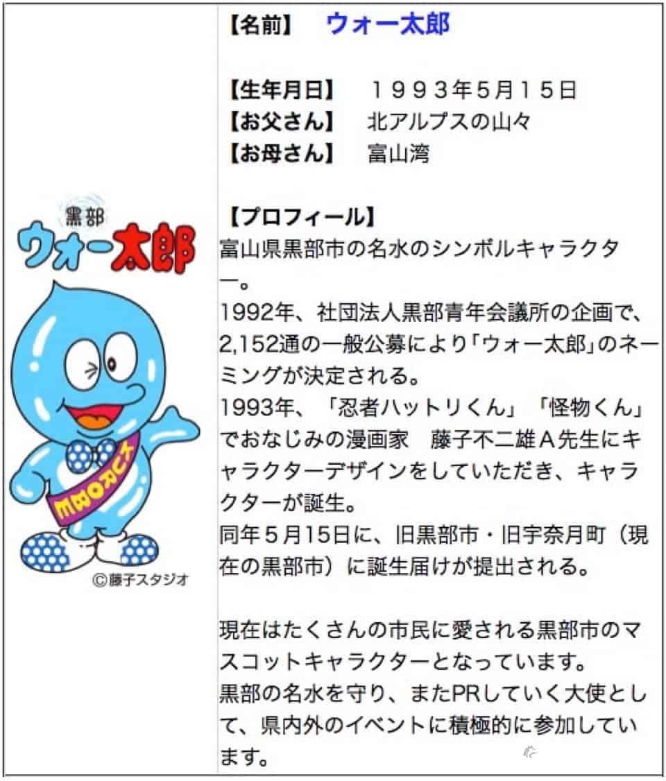
(Quoted from 太郎 War Taro supporters club HP)
KurobeWell respectedYuru Charawas. The sign that appears on this steep horizontal footpath was a funny laugh that this combination of characters could not be said (laughs)
To Shiaitani Tunnel
This tunnel takes about 4-5 minutes to pass.
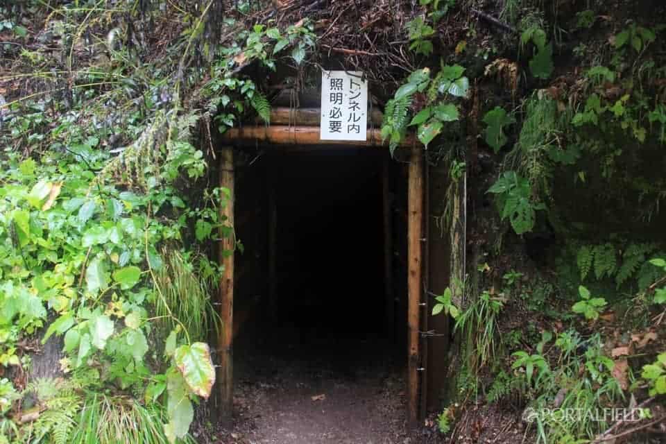
I left the tunnel. InsideCompletely darkSoHEDEN and flashlight are required.
It was true that "footage running water" was true, but because the water was allowed to flow to the roadside from where the amount of water increased, the ground inside the tunnel wasIt doesn't mean it's totally submergedwas. It was such an impression even on this day's rain, so it was an impression that you might not need to worry so much about getting wet. Or maybe it was just raining and I was already getting wet inside of my shoes because I made a foot on the foot, so I just didn't care too much (laughs)

This meansOld type billboard. I do not feel a bit surprised, but this is good enough to have a taste with this.
Beyond the tunnel
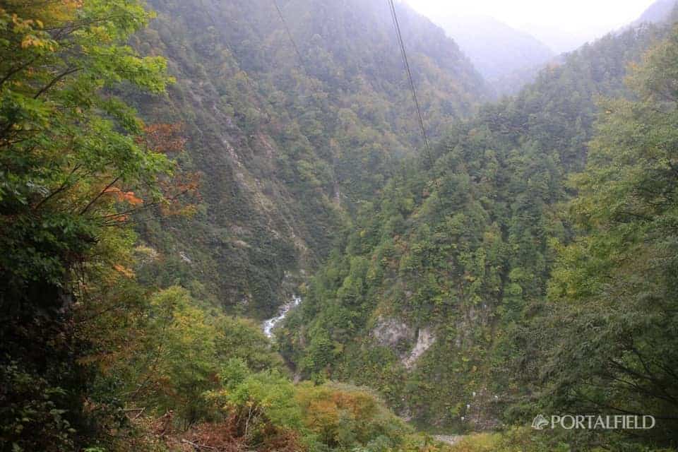
When I left the tunnel, I looked back on the way I walked.
This way will continue, but when it comes to this area, it will be over when it comes to, and it feels like a little sadness.
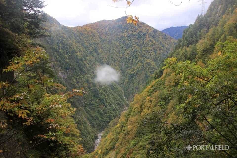
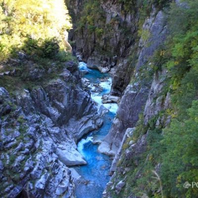
Right back is the Kurobe River upstream direction. Exactly V-shaped valley.
It will be beautiful if it leaves a little more. It seems that about the next week was about to see.
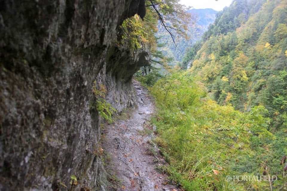
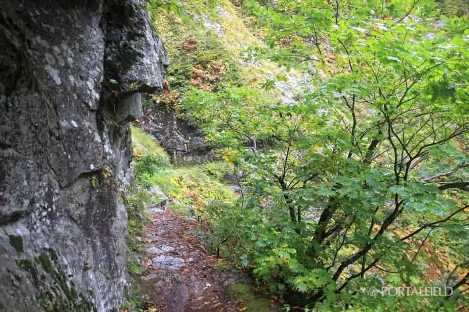
In addition to the feet getting a little wider, there are plants on the roadside, so you can ease your fear or sense of altitude.
I am reminded of how much effort was used to construct this footpath.
I did not notice when I was walking, but at the topTransmission line iron towerI can see a little. little by littleJinpingI feel that I am approaching.
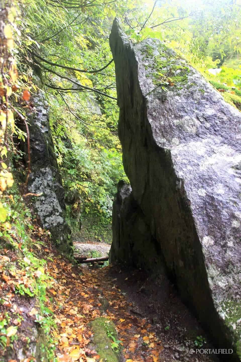
The rock that suddenly appeared and I was related to it in the northern alpsDolphins in Mt. TsubakurodakeThe rock of the example that formed. It seems that there is such an atmosphere somehow. Even so, was the rock cut down according to the road width? It also feels too slick to be natural. Considering the sidewalk, it would be easy enough to scrape the rock.
Shiaiya lodge ruins discovery
A few minutes walk from there, I was killed by a bubble snowfall just before the tunnel of Shiaitani.Shiaiya lodgingsI talked about this, but this area is just on the opposite side. As I found out later,Apparently there is a point where you can see the ruins of Shiaiya lodgeIt seems. When I was walking, I did not notice at all, or I could not notice it, but it happened to appear in the video camera I was shooting.
First of all, it is what kind of lodging the house is, but various people succeeded in photography.Digital version of Asahi ShimbunBut"A worker's dorm ruins left in the valley bottom of Shiai Valley, attacked by bubble snowfall in 1938"It was also mentioned as This is originally a five-story rebar, and what you can see now is thatJoint part of the first floor and the second floor.
And here is an image cut out from the video that happened to be taken by the movie camera.
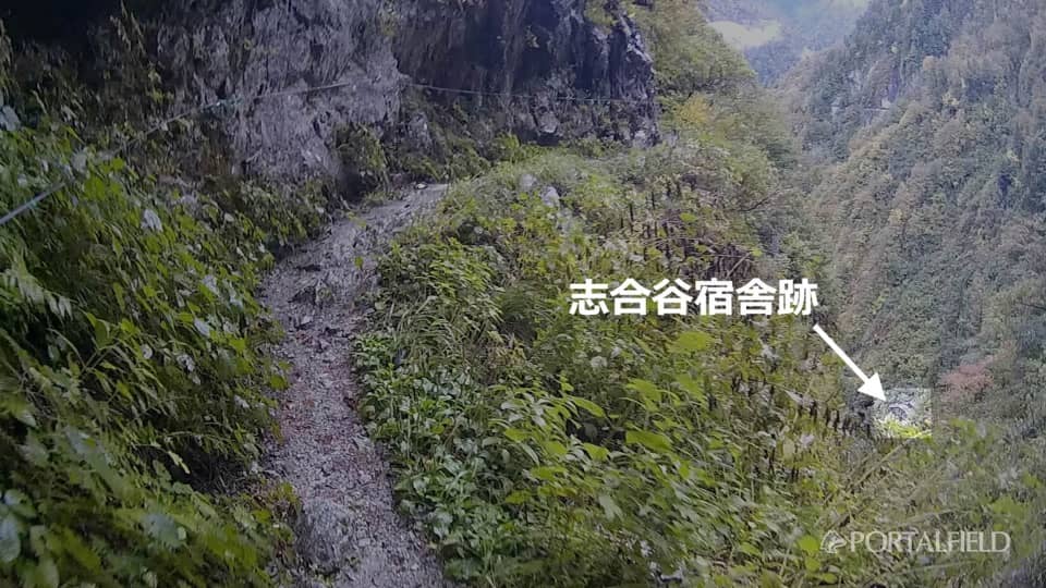
It seems to be considerably lower than the levelwalk. In construction,
We used the opinions and references of experts such as plant growth conditions, topography, snow cover, wind direction in winter, etc.
Quote from Akira Yoshimura "High Heat Pass"
And. It seems that it was selected because it would be the place where the probability of occurrence of avalanche would be the lowest, but it turns out that it was a steep place with a mountain wall soaring behind it. I knew that there were lodgings, but I did not think that they still remained in this way.
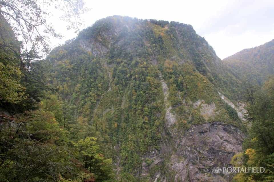
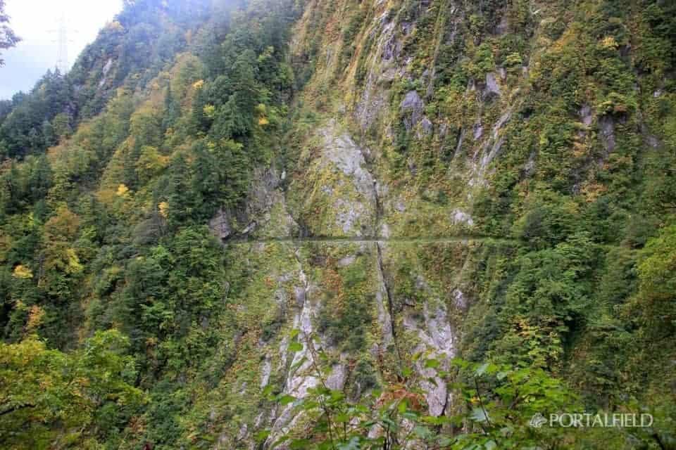
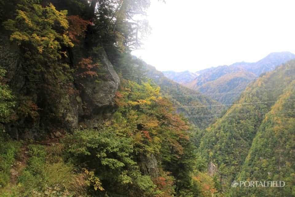
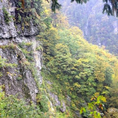
This isWest wall of Okugengshanis. The second through fifth floors of the room that was blown away collided with this rock wall from the place just before crossing the valley. The text of the novel is also powerful, so it reminds me of it, but if you look at it actuallyOverwhelming presence of rock wallsIs approaching in front of you.
The side with the horizontal trail is also completely rocky. As trees grow from the cracks in the rock,A kind of unique sightis. The rock on the back of Mt. Kanegani is reflected on the right of this photo.
Arrive at Shibuya
Walk through the tunnel of Shiai Valley about 40 minutes,8: 55 aroundToKiritaniArrive at (Jijimi Midori). This is not the point of the "Yama-To-Kogen-Chizu" map, so it is hard to tell if it is earlier or later than the course time at this point, but it comes at a good pace to experience Feeling.
JinpingSince it has become one breath away until now, I will proceed as it is.
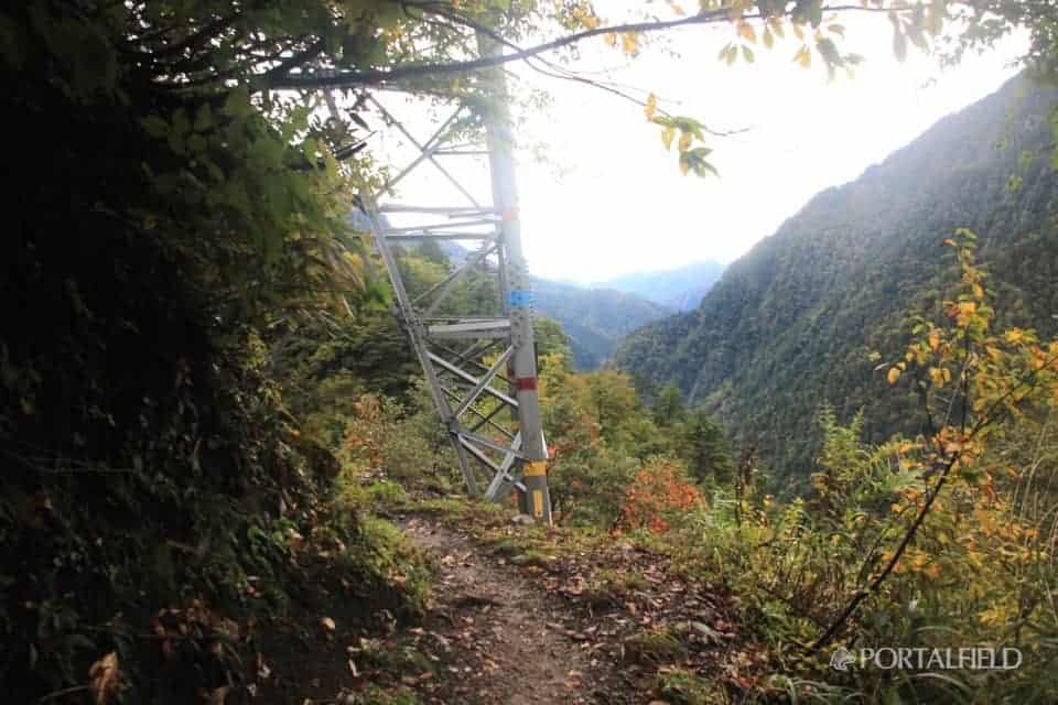
Steel towerHas been seen. On some blogs "When you see the tower, the descent to Kohei startsI have a memory that I saw a description like "", so when I look at the clock I already reached that point, it is still 9. Even though you've been walking at a good pace, somehow it's too early?
Around here, the feeling of the road is also a horizontal footpath that cuts through the rocky mountainPart of soil increases in step and atmosphere is normal mountain roadI think it was about to come,
not yetA trail that looks like a sidewalk normally(Laughs) However, the power line is still visible, and it is felt in the skin that the lower bound is near.
Finally the character of Kohei!
Upper part of JinpingArrival in. finally"JinpingWe came to the point with the letter "".Kurobe Dam Station XNUM X kmAfter all, I have walked a lot.Kotohira StationUntil after1.3kmIt's just one more breath.
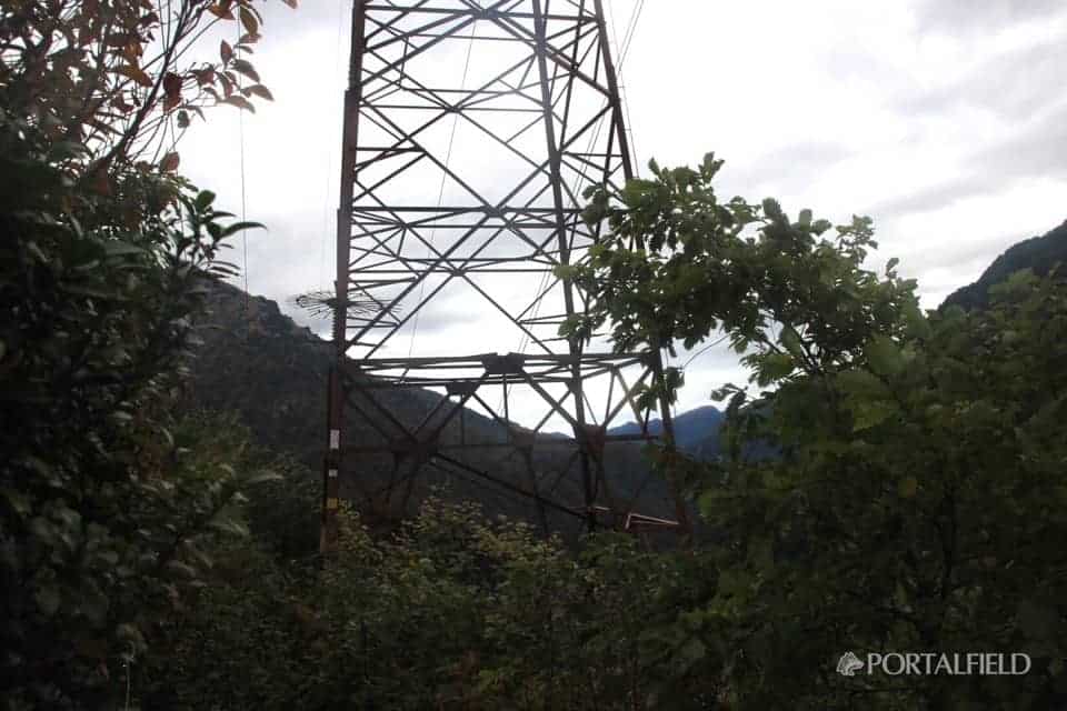
You can see another tower from this side. It is no doubt that this steel tower is the one that is in the place of going down to Jinping.Goodbye to the sidewalk.
From the towerForest slopesGoing down As we descend at a short distance at a short distance from the height of the sidewalk to the foothills of the valley, we get quite a foot.Lastly, I fell here and got hurt, and I'm not even laughing.So, while holding back the legs, but still, still come a little too soon after all (laughs)
It is also the point of "Yama-To-Kogen-Chizu" map,The monkey fly gorge promenadeCame to the fork.
"From here, it is a mountain trail for advanced users."It is pasted in a lingering place, and it's quite difficult (laughs) There is no such signboard when walking out from the Kurobe Dam Station side.
The downhill trail continues from here, but it becomes easier to walk at once, and the maintained stairs will come out along the way.It's the last time I fell over here and injured, and that's not a laugh either(Laughs) I went down carefully.
Kurobe River upstream directionThe scenery of is also paid close to here.
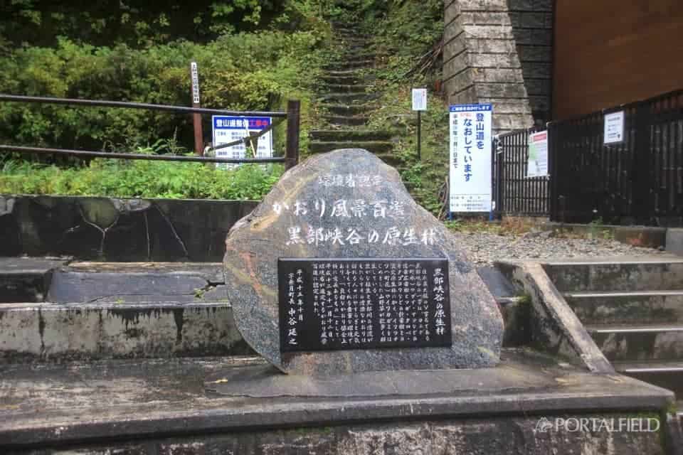
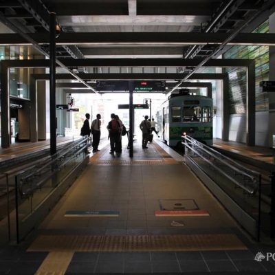
Finally arrived at Kotohira Station!
Lower corridor consisting of a horizontal footpath and an old Nichido sidewalkLeading toMountain climbing mouth of JinpingI went down to
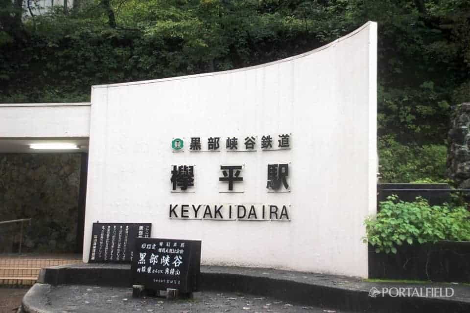
10: 10 around,finallyArrive at the final destination, Kotohira Station!
I left Azohara Onsen GoyaX NUM X pastBecause I was walking, I was able to walk at a good pace slightly faster than the course time. It is a good thing considering that it was raining.
I met again with those two people who walked forward from the middle.Thank you very much!
Previous articleXNUM X Moon X NUM X hen-X NUM Azohara Onsen Goya → large drumIs here.

Related to this daymikketa(Mikke) ”mountain hut information and weather forecast
Azohara Onsen Goya
This article was relocated to "PORTALFIELD" in 2016 month in 10 month. Some corrections have been made to relocate the article. (PORTALFIELD Takahashi)
Other articles of "2016 lower corridor, walk on the old Nichiden sidewalk"
2016 lower corridor, walking the old NDC footpath 10/15 edition Ogisawa → Kurobe dam → Lodge Kuroyon
2016 / 10 / 15 ~ 17 walk from the Shimono corridor, the old Niden walkway route, 1 day 10 / 15 access to Kurobe dam & lodge Kuroyon accommodation. Itinerary: Shinjuku → Shinano Omachi → Ogizawa → Kurobe Dam → Lodge Kuroyon. In 2016 this year, the Shimono Corridor opens! The Tateyama and Kurobe areas are basically areas where the Tateyama Kurobe Alpine Route is often used, More
From the lower corridor, which used to walk on the date of 2016 / 10 / 15 to 17, from the former Nichido trail route, from lodge Kuroyon of XNUM day 2 / 10 to Azohara Onsen Goya, lodge Kuroyon → built-in Sugaya Ide Hen. The travel map is here. On this day's journey, lodge Kuroyon → Kurobe Dam → Built-In Sotani Ide → Betsukan Valley Ide → Hakuryu Gorge → Cross Gorge → S-shaped Gorge → Senjin Valley Dam → Azohara Onsen Goya. More
From the lower corridor, which used to walk on the date of 2016 / 10 / 15 to 17, from the former Nippon Electric trail route, from the lodge Kuroyon of the XNUM X day 2 / 10 to Azohara Onsen Goya, built-in Sugaya Idei → another Yamaya Ide. The travel map is here. On this day's journey, lodge Kuroyon → Kurobe Dam → Built-In Sotani Ide → Betsukan Valley Ide → Hakuryu Gorge → Cross Gorge → S-shaped Gorge → Senjin Valley Dam → Azohara Onsen Goya. More
From the lower corridor, which has walked on the date of 2016 / 10 / 15 to 17, from the old Nichido trail route, from lodge Kuroyon of the XNUM day 2 / 10 to Azohara Onsen Goya, another mountain valley Ide → Cross Gorge. The travel map is here. On this day's journey, lodge Kuroyon → Kurobe Dam → Built-In Sotani Ide → Betsukan Valley Ide → Hakuryu Gorge → Cross Gorge → S-shaped Gorge → Senjin Valley Dam → Azohara Onsen Goya. More
From the lower corridor, which has walked on the date of 2016 / 10 / 15 to 17, from the former Nippon Electric Trail route, from the lodge Kuroyon of the XNUM day 2 / 10 to the Azohara Onsen Goya, the Cross Gorge → S-shaped Gorge. The travel map is here. On this day's journey, lodge Kuroyon → Kurobe Dam → Built-In Sotani Ide → Betsukan Valley Ide → Hakuryu Gorge → Cross Gorge → S-shaped Gorge → Senjin Valley Dam → Azohara Onsen Goya. More
From the lower corridor in the 2016 / 10 / 15 to 17, from the old Nichido trail route, from the lodge Kuroyon of the XNUM day 2 / 10 to Azohara Onsen Goya, S-shaped → Senjindani Dam → Azohara Onsen Goya ed. The travel map is here. On this day's journey, lodge Kuroyon → Kurobe Dam → Built-In Sotani Ide → Betsukan Valley Ide → Hakuryu Gorge → Cross Gorge → S-shaped Gorge → Senjin Valley Dam → Azohara Onsen Goya. More
From the lower corridor, the old Nichido footpath, and the horizontal footpath route that I have walked on the date of 2016 / 10 / 15 to 17, from Azohara Onsen Goya on XNUM X day 3 / 10 Oriodani Sabo embankment tunnel → large drum edition. The travel map is here. The journey on this day is Azohara Onsen Goya → Oriodani Sabo embankment tunnel → large drum → Shiaitani tunnel → Kiritani → Kotohira → Unazuki → Unazuki → Toyama → Tokyo. More
From the lower corridor, the old Nichido footpath, and the horizontal footpath route that I have walked on the date of 2016 / 10 / 15 to 17, from Azohara Onsen Goya on XNUM X day 3 / 10 → Toyama edition. The travel map is here. The journey on this day is Azohara Onsen Goya → Oriodani → Daikoko → Shiaitani Tunnel → Ashiya → Kotohira → Unazuki → Toyama → Tokyo. Also includes the eating walk in Toyama. More