

The journey of the day:Lodge Kuroyon→ Kurobe Dam → Built-In Sotani Idei → Beppu Yamaya Idei → Hakuryu Gorge → Cross Gorge → S-shaped Gorge → Sento Valley Dam →Azohara Onsen Goya
Sections introduced on this page: Betsuzan Valley Ide → Hakuryu Gorge → Cross Gorge
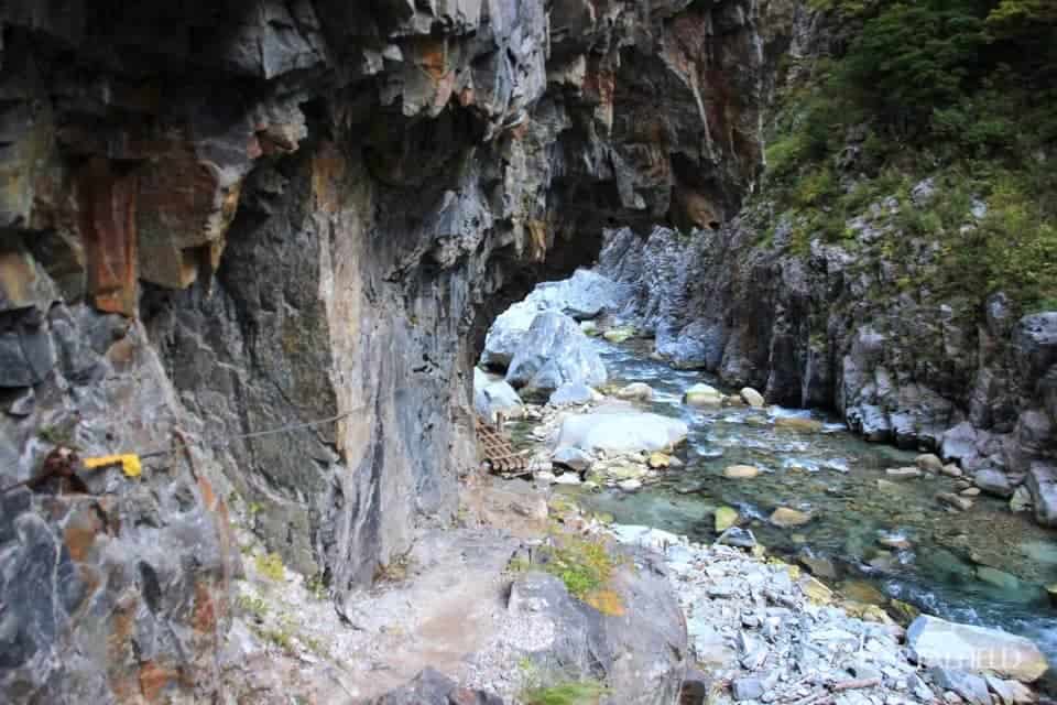
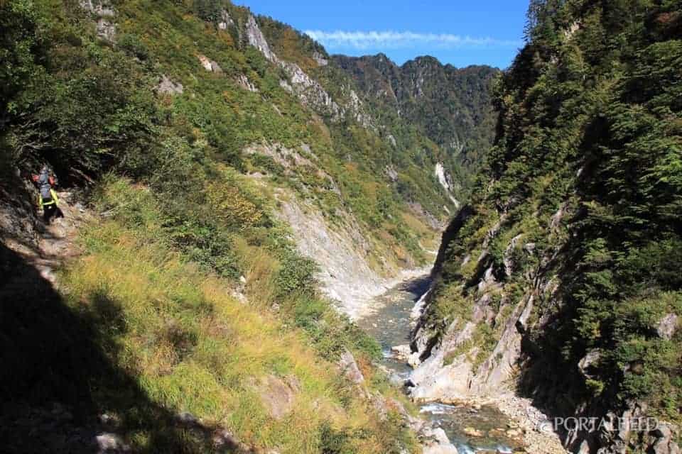
Be careful of difficult places near Hakuryukyo
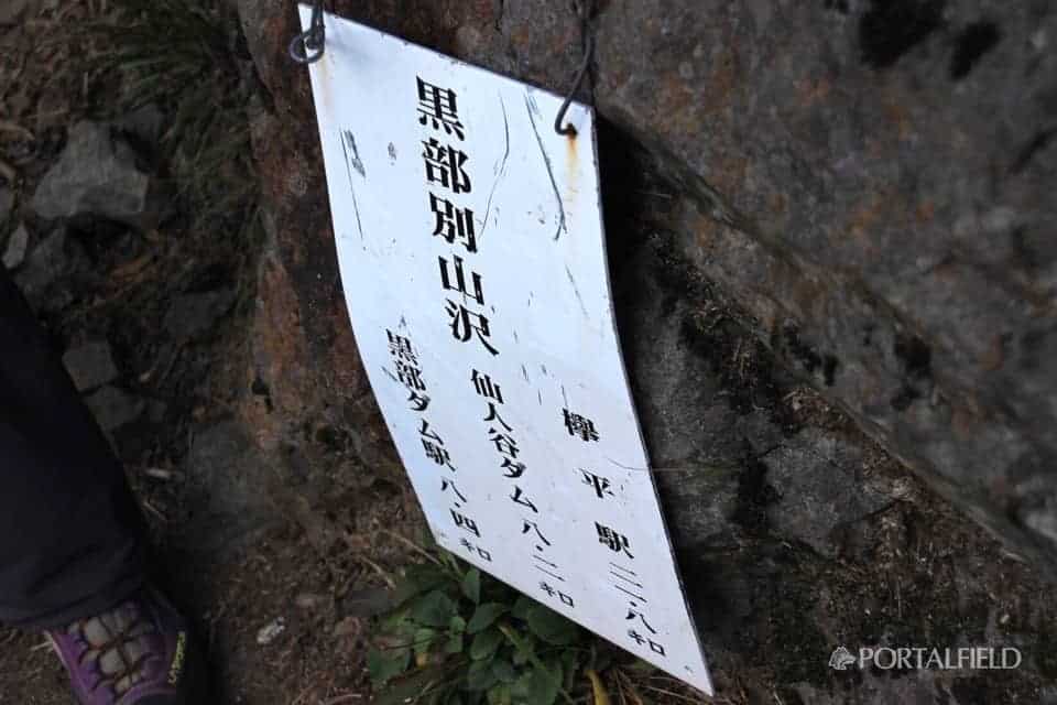
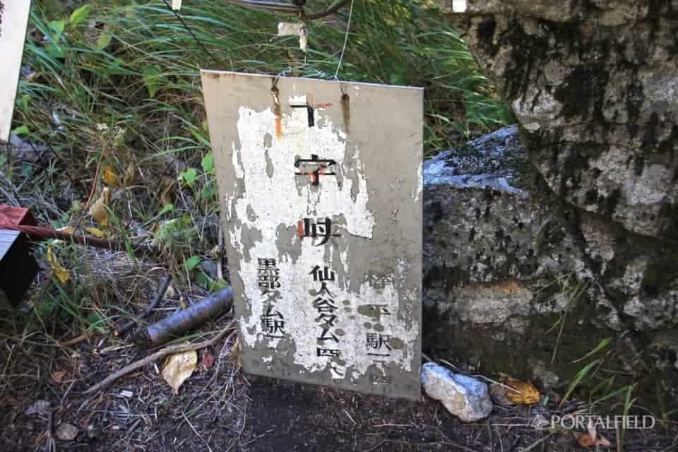
I left Betsuyamaya Ideai (Kurobebetsu Yamazawa), first of allHakuryukyoHead for
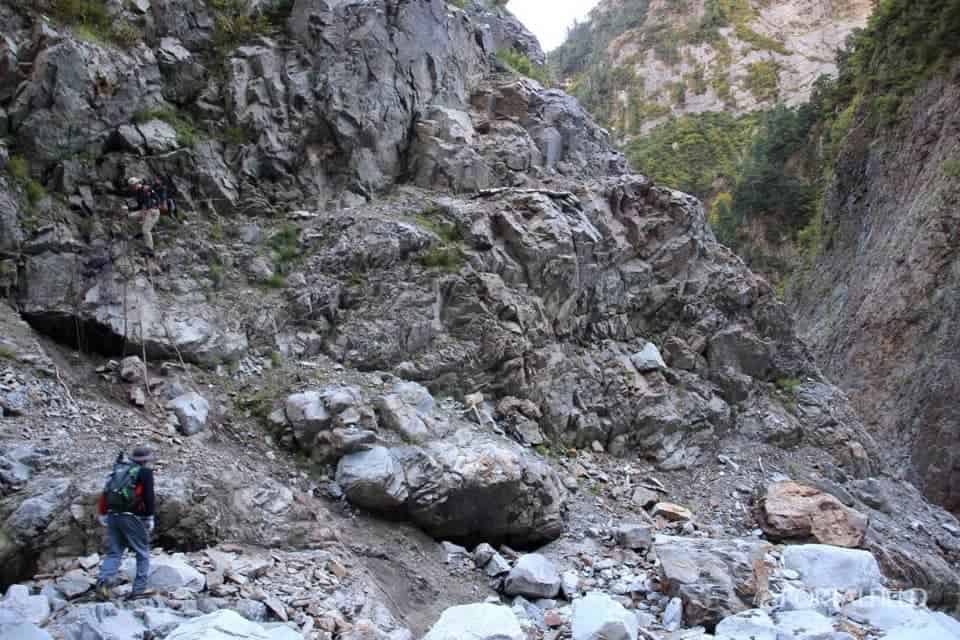
The place of encounter is a little rocky place, and it feels like it climbs up the amount that went down. There is no problem so much because the scaffolding is installed on the rock, but it is a little caution because the slope under the rock is unstable.
Until Hakuryukyo, it takes about 20 for course time from Ieyama to Beyukadani, but a steep road will follow and some difficult places will come out. When I remember over the whole route, there were many places where maintenance did not catch up after all in this section.
In terms of how the rock gets wet and the condition of the weir, you can imagine the situation when the amount of water increases.
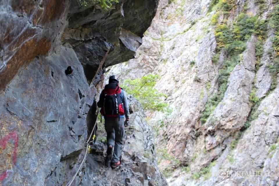
In this area, it is usual to put a rope in place of 2 wires, as the maintenance of the track has not caught up.
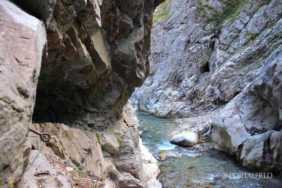
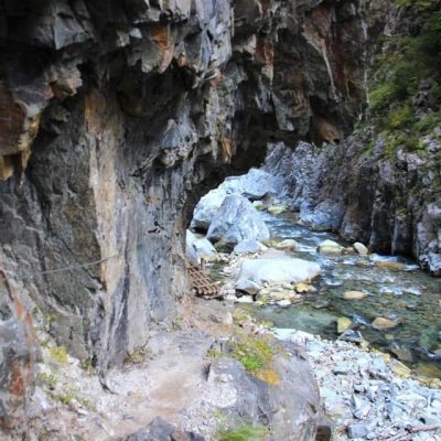
The rock wall was overhanging and it felt quite oppressive.
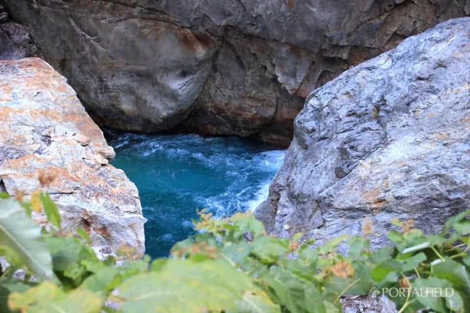
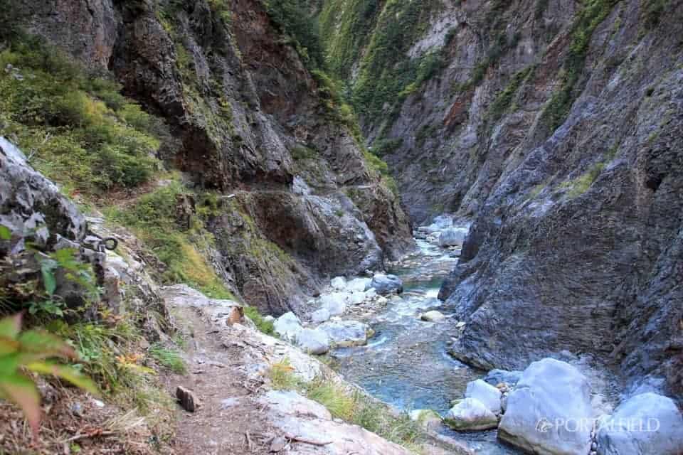
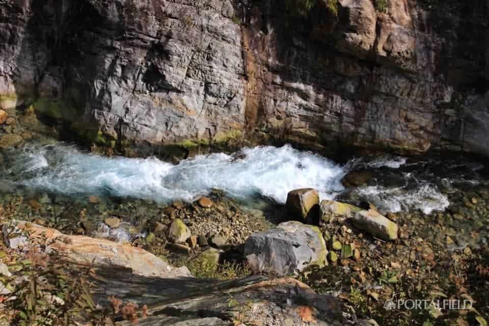
Not only is the flow fast, it looks pretty deep here.
I am fascinated by this flow. However, it is a section where the road is narrow, so you may not be able to look very slowly.
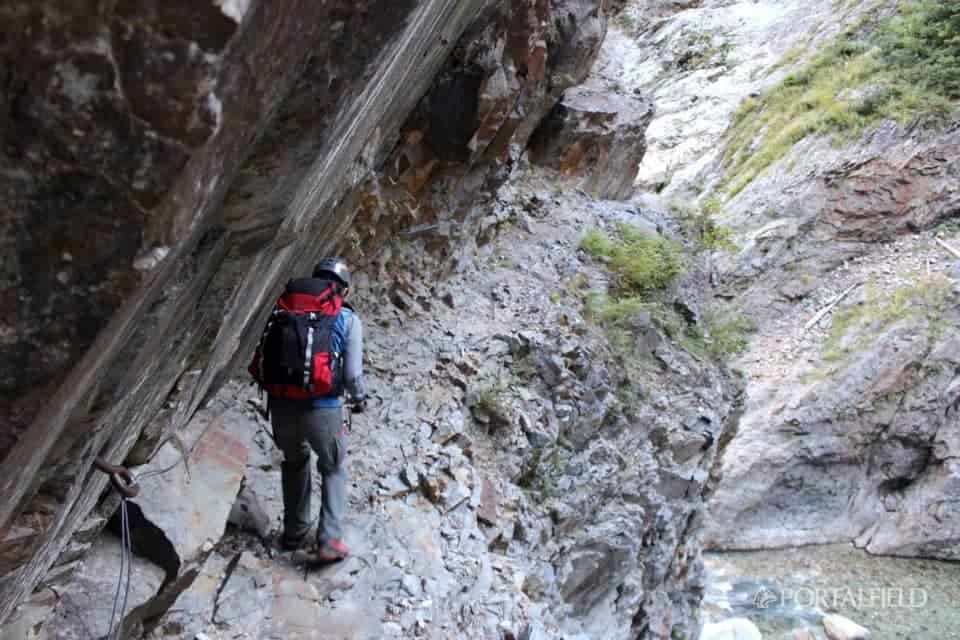
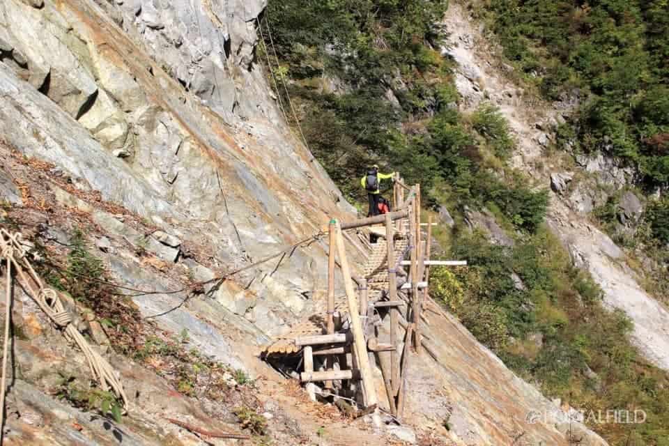
The difficult point finally appeared
Beyond here, around hereThe most difficult placeComes out.
At the end of the fallen scaffold, I turn almost right at the left,I can not see for a moment the place I can put my feet.
The part where the foot can be hung is one step lower, and it is difficult to see the scaffolding because the rock is overhanging,An illusion that the road is over hereI rememberThank you very much for this line in this place.
As for this point, it may be a bit easier to walk because it will form a climb when coming from the Ashihara side.Slip point caution point.
The section where the mind does not go on continues."Yama-To-Kogen-Chizu" mapThen this section "Caution for falling downThere is a statement of ".
It is not a story that is limited to this area, but it is likely that the rocks and footsteps will slide considerably on rainy days and after the rain,Root difficultyI wonder if it will be pretty up. I do not enjoy the view and I do not recommend it on rainy days.
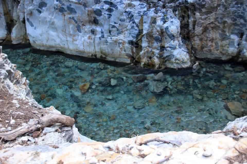
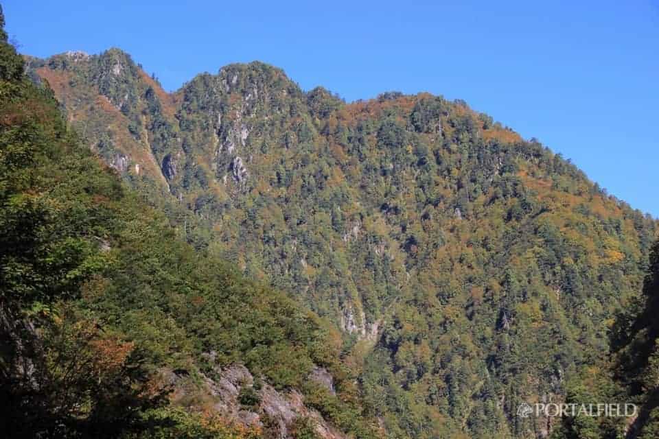
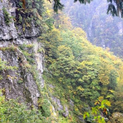
Even so, good color.
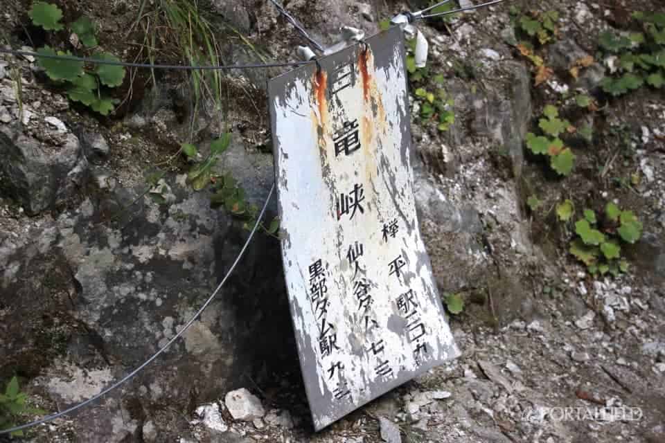
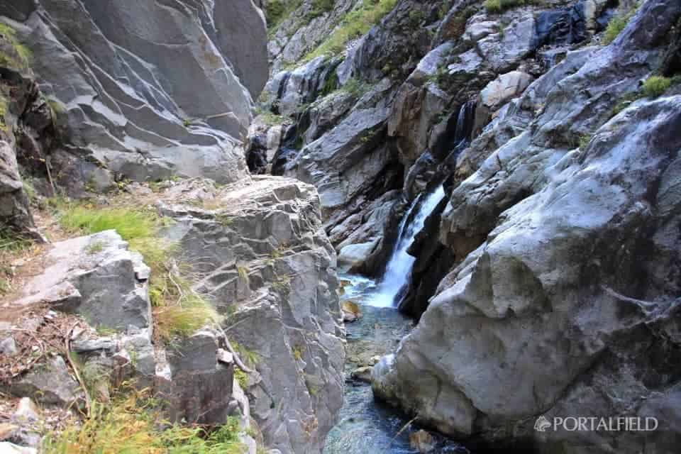
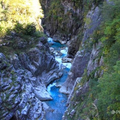
HakuryukyoI came to the signboard of. It is about 40 minutes from Ideyama Tani.
The course time for the same section is 20 minutes on the "Yama-To-Kogen-Chizu" map, but you can walk without taking any photosIt may be a little tough for 20What an impression. I also eat quite a bit of time when I am passing each other. The two people who were walking through were taken the same amount of time.
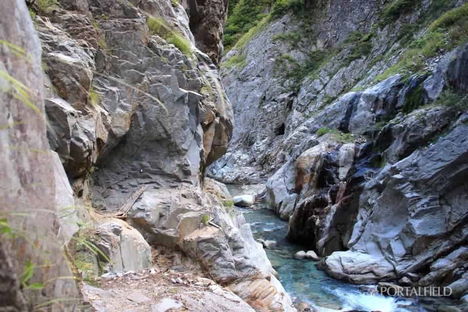
Pass the Hakuryu Gorge safely to the Cross Gorge

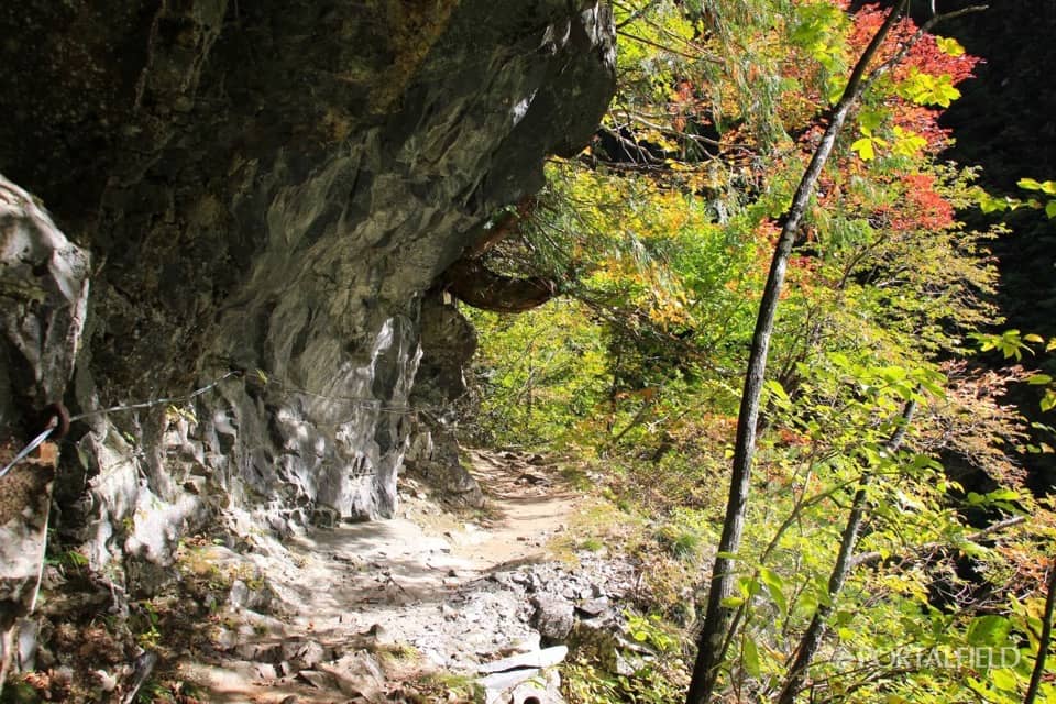
From Hakuryukyo, the feeling of the road gradually returns to the original feeling.
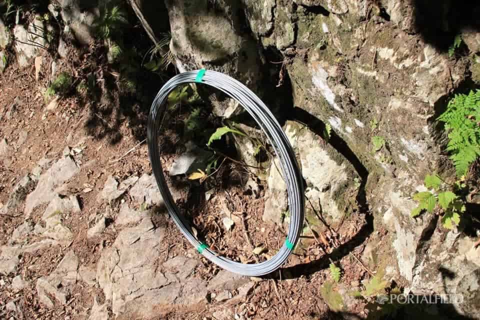
There was a wire that seems to be for repair of the grid. There is only thickness of about 4-5mm, but this wireHow much I felt helped.
The route will gradually rise in height after passing the Hakuryu Gorge.
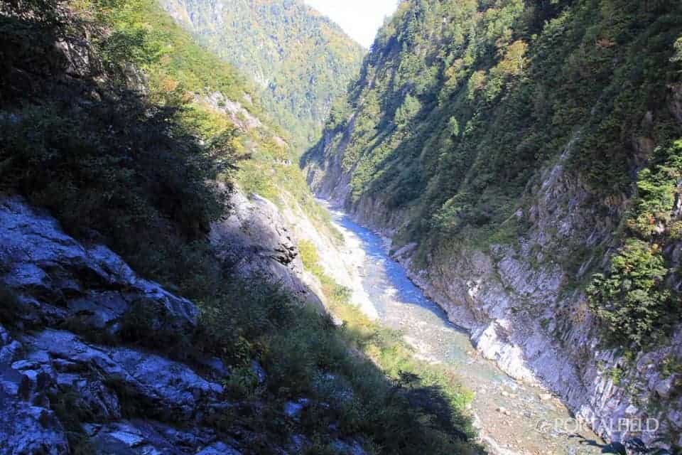
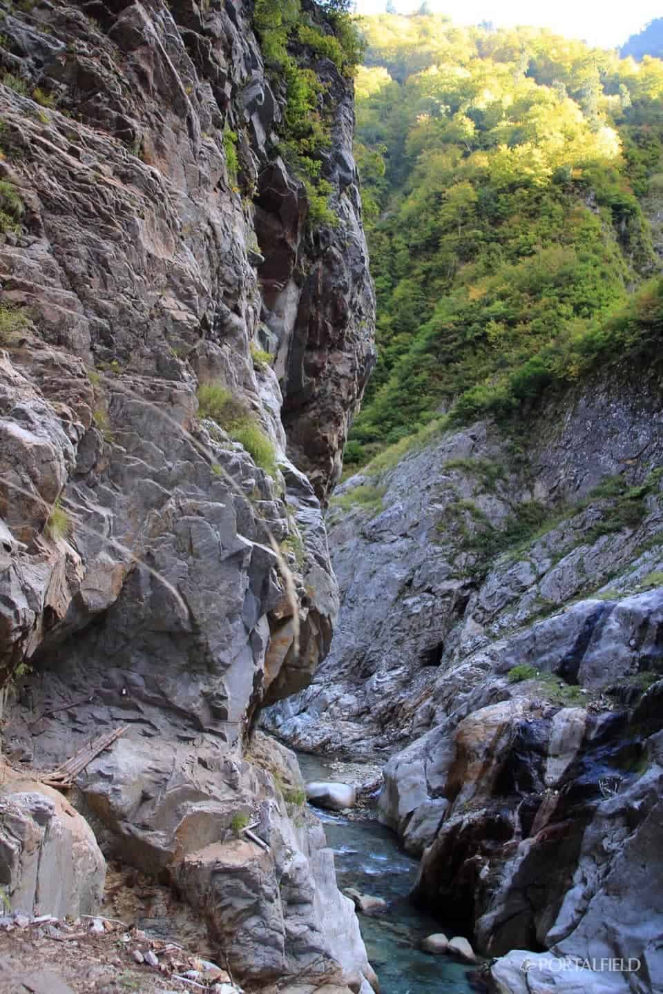
Because the plants and trees are attached, the feeling of fear diminishes somewhat,Usually cliffs.
It will be beautiful when it leaves.
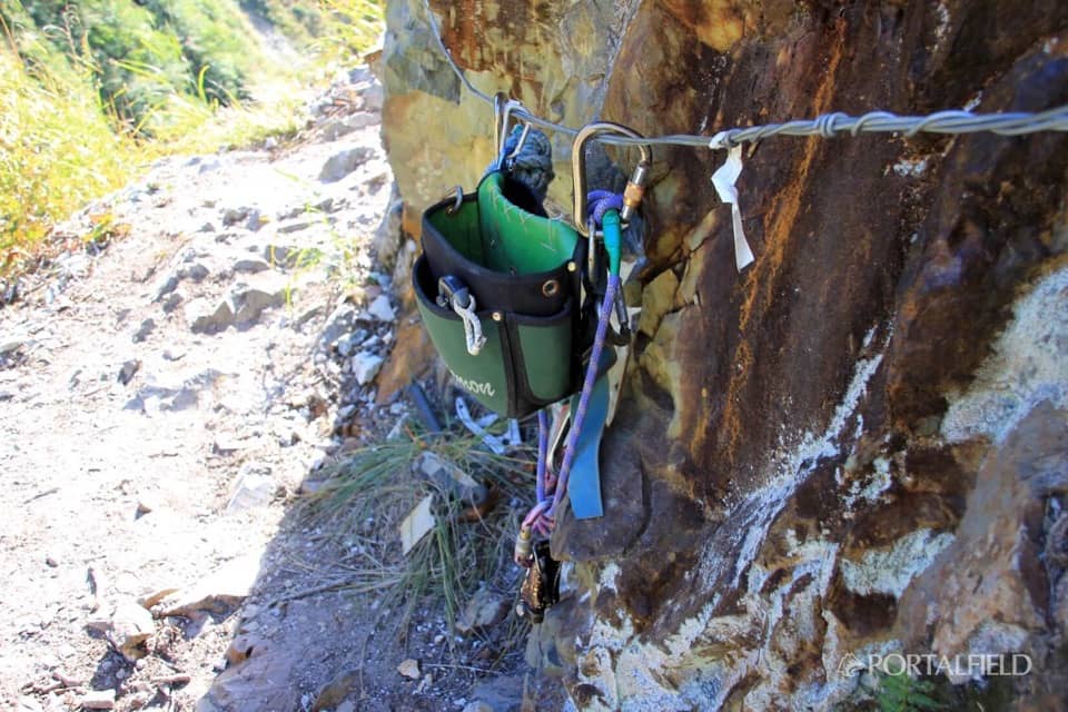
There was a tool for those who were to maintain the road. Thank you very much.
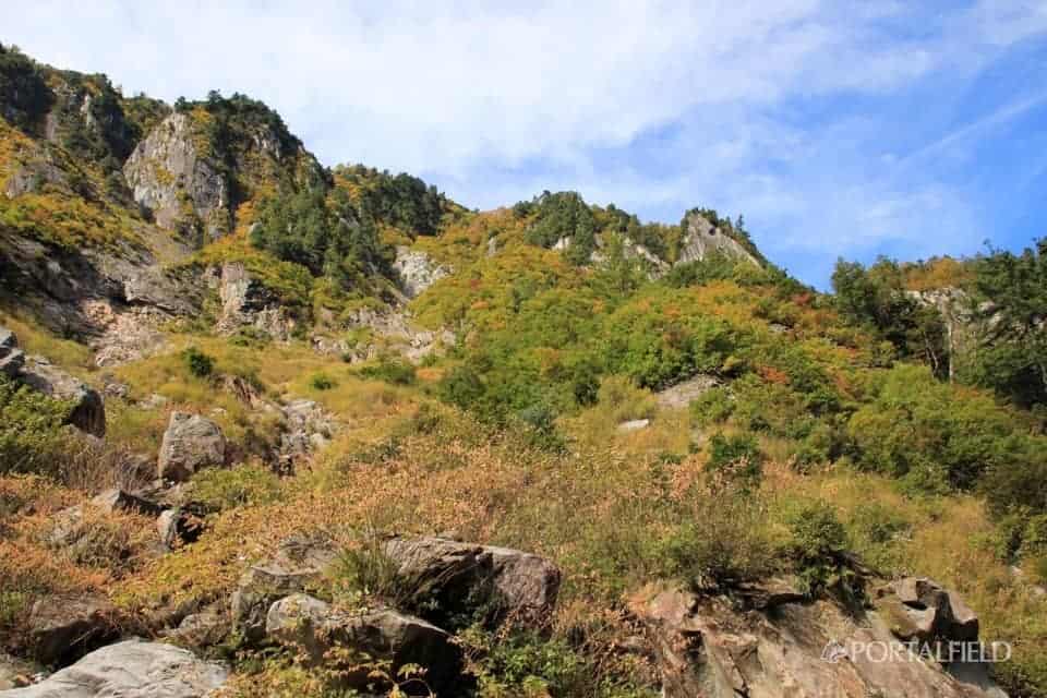
It seems that it will take a little while until this area also turns into autumn leaves.
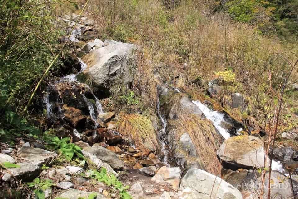
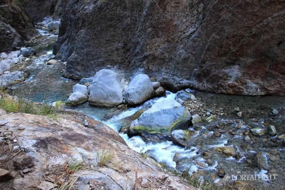
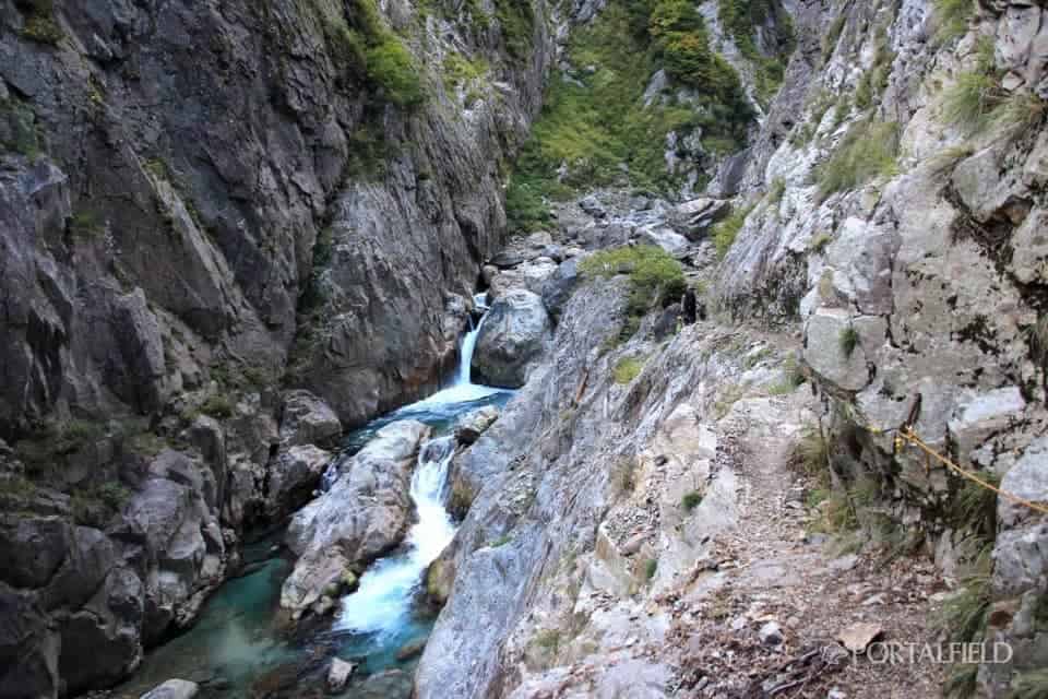
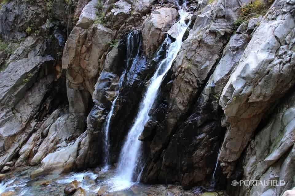
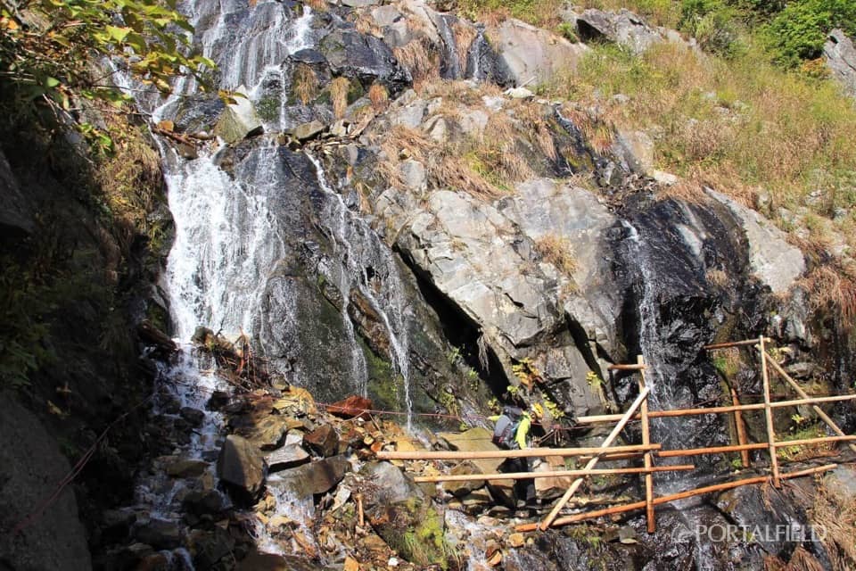
A waterfall beside the road is like a waterfall.
From here to here, there are many places like this waterfall, which pass through Kotohira. You can pass here without getting wet,I will come ahead of you(Lol)
Where it fell a few years agoScaffolding has been established. The train line was also stretched for a while, but it also had handrails because it was difficult to reach.
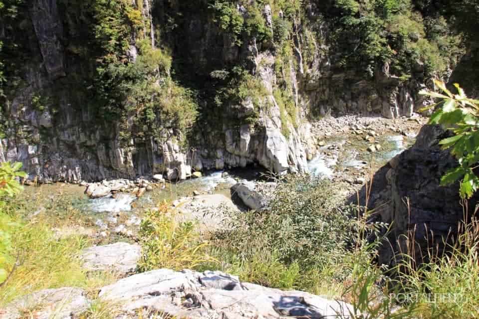
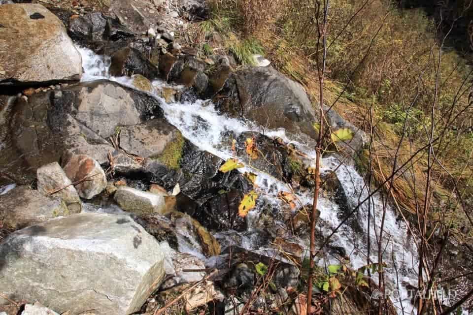
Below the footsteps is like this. It is a torrent.
It has arrived. today'sWaterfall line location.
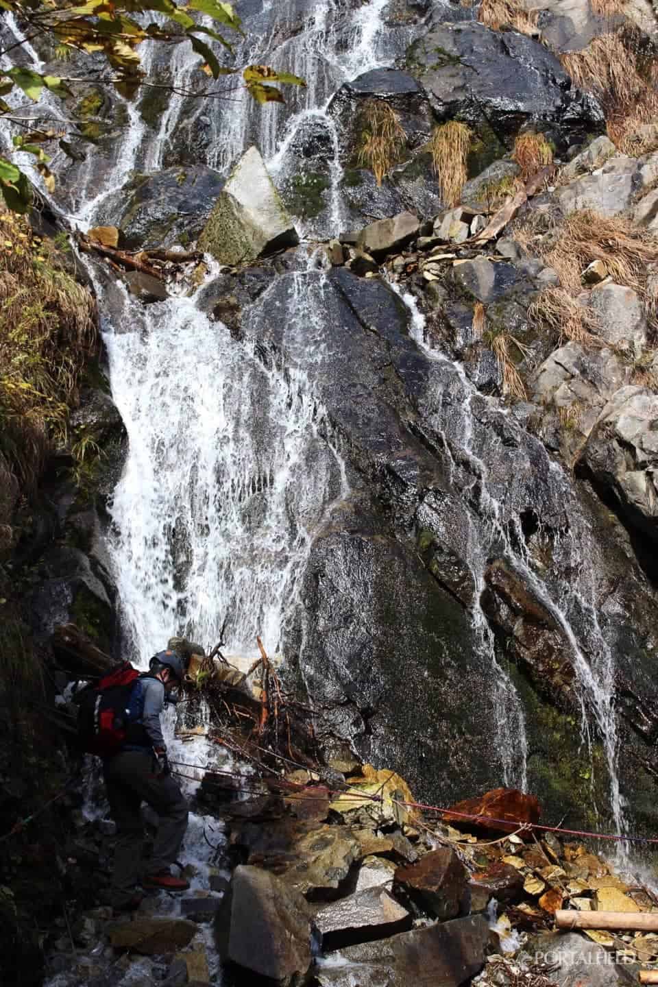
Because a considerable amount of water flows at your feetI walk while I care about slippery slipperySo I can not pass very quickly.
If you look back on it now, it may be a dangerous spot unexpectedly. What seems to be fence-like seems to be slip prevention.
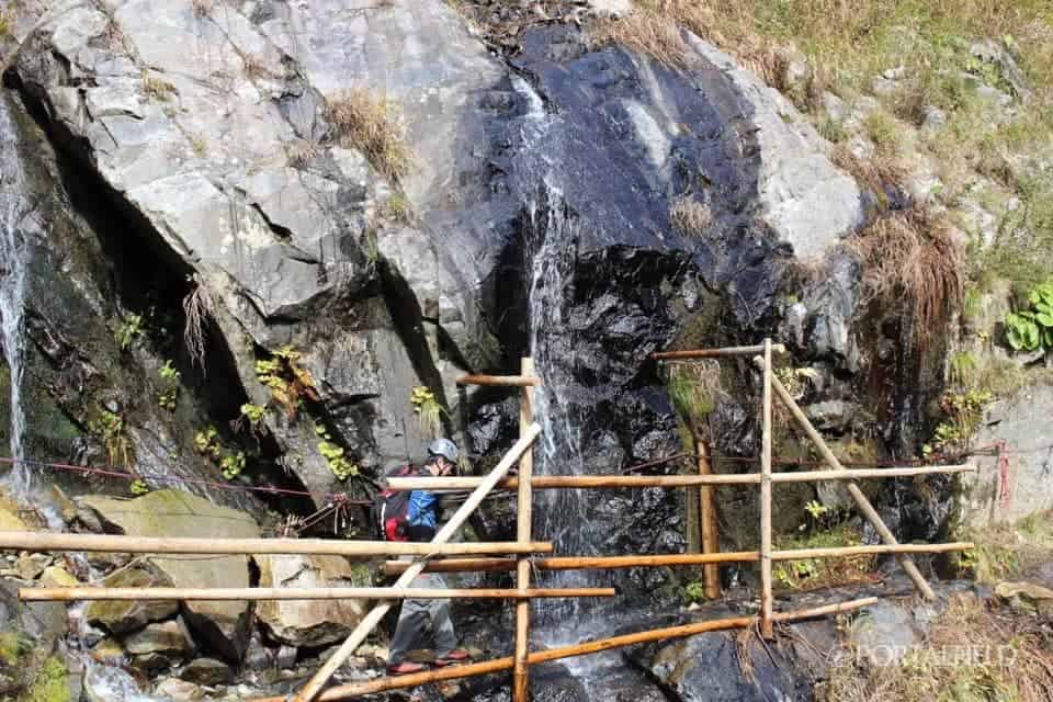
Anyway, here is the water that flows down from above,I definitely get wet(Lol)
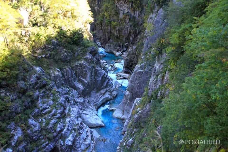
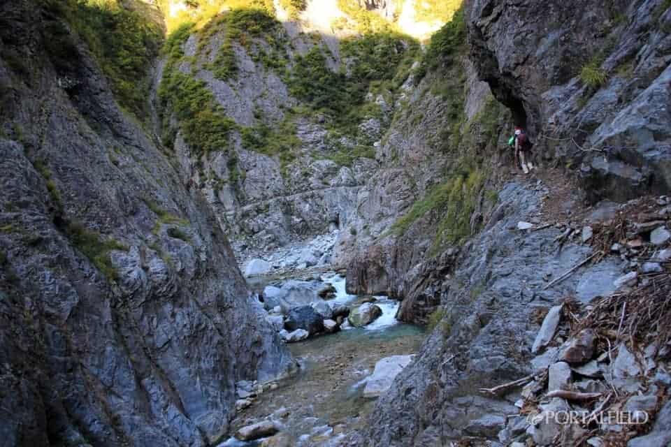
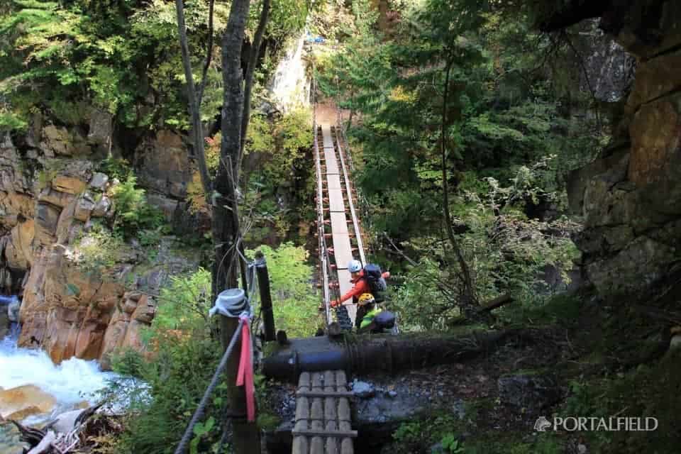
From this area there are more trees and the road atmosphere is changing again. If the autumn leaves here, it will be a superb view point.Cross GorgeIs coming soon.
Cross Gorge SquareI came out to.
From here you can go down to the riverside where you can see the Cross Gorge close up, but go down a little where there is a fair slope like a ropeIt looks like it is hard to climb back,When.
There is no guide here, so I think that there are many people passing by without noticing that they can go down. I'm walking at a very good pace so far, so let's walk as it is,You should be able to see the cross even in the future, I was wearing a hawk, but there was no point in the future (lol)
In fact, it is located beyond the Cross Gorge SquareSeen from above the Cross Gorge Suspension BridgeI do not notice it at all. .
(XNUM X Year X NUM X Month X NUM X Date Added)
A picture of the Cross Gorge was posted on the next "XNUM X Mon X Num Nd-XNUM X Cross Gorge → S-Shape Gorge". Please have a look.
When going down a little from Cross Square SquareCross Gorge Suspension Bridge.
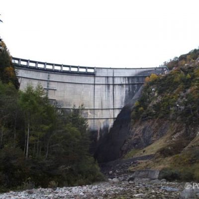
The Senjindani Dam is approaching. I remember that I felt relieved when I came here, the remaining distance decreased.

Related to this daymikketa(Mikke) ”mountain hut information and weather forecast
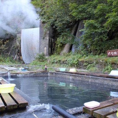
Azohara Onsen Goya
Lodge Kuroyon
This article was relocated to "PORTALFIELD" in 2016 month in 10 month. Some corrections have been made to relocate the article. (PORTALFIELD Takahashi)
Other articles of "2016 lower corridor, walk on the old Nichiden sidewalk"
2016 lower corridor, walking the old NDC footpath 10/15 edition Ogisawa → Kurobe dam → Lodge Kuroyon
2016 / 10 / 15 ~ 17 walk from the Shimono corridor, the old Niden walkway route, 1 day 10 / 15 access to Kurobe dam & lodge Kuroyon accommodation. Itinerary: Shinjuku → Shinano Omachi → Ogizawa → Kurobe Dam → Lodge Kuroyon. In 2016 this year, the Shimono Corridor opens! The Tateyama and Kurobe areas are basically areas where the Tateyama Kurobe Alpine Route is often used, More
From the lower corridor, which used to walk on the date of 2016 / 10 / 15 to 17, from the former Nichido trail route, from lodge Kuroyon of XNUM day 2 / 10 to Azohara Onsen Goya, lodge Kuroyon → built-in Sugaya Ide Hen. The travel map is here. On this day's journey, lodge Kuroyon → Kurobe Dam → Built-In Sotani Ide → Betsukan Valley Ide → Hakuryu Gorge → Cross Gorge → S-shaped Gorge → Senjin Valley Dam → Azohara Onsen Goya. More
From the lower corridor, which used to walk on the date of 2016 / 10 / 15 to 17, from the former Nippon Electric trail route, from the lodge Kuroyon of the XNUM X day 2 / 10 to Azohara Onsen Goya, built-in Sugaya Idei → another Yamaya Ide. The travel map is here. On this day's journey, lodge Kuroyon → Kurobe Dam → Built-In Sotani Ide → Betsukan Valley Ide → Hakuryu Gorge → Cross Gorge → S-shaped Gorge → Senjin Valley Dam → Azohara Onsen Goya. More
From the lower corridor, which has walked on the date of 2016 / 10 / 15 to 17, from the former Nippon Electric Trail route, from the lodge Kuroyon of the XNUM day 2 / 10 to the Azohara Onsen Goya, the Cross Gorge → S-shaped Gorge. The travel map is here. On this day's journey, lodge Kuroyon → Kurobe Dam → Built-In Sotani Ide → Betsukan Valley Ide → Hakuryu Gorge → Cross Gorge → S-shaped Gorge → Senjin Valley Dam → Azohara Onsen Goya. More
From the lower corridor in the 2016 / 10 / 15 to 17, from the old Nichido trail route, from the lodge Kuroyon of the XNUM day 2 / 10 to Azohara Onsen Goya, S-shaped → Senjindani Dam → Azohara Onsen Goya ed. The travel map is here. On this day's journey, lodge Kuroyon → Kurobe Dam → Built-In Sotani Ide → Betsukan Valley Ide → Hakuryu Gorge → Cross Gorge → S-shaped Gorge → Senjin Valley Dam → Azohara Onsen Goya. More
From the lower corridor, the old Nichido footpath, and the horizontal footpath route that I have walked on the date of 2016 / 10 / 15 to 17, from Azohara Onsen Goya on XNUM X day 3 / 10 Oriodani Sabo embankment tunnel → large drum edition. The travel map is here. The journey on this day is Azohara Onsen Goya → Oriodani Sabo embankment tunnel → large drum → Shiaitani tunnel → Kiritani → Kotohira → Unazuki → Unazuki → Toyama → Tokyo. More
From the lower corridor, the old Nichido footpath, and the horizontal footpath route that I have walked on the date of 2016 / 10 / 15 to 17, from Azohara Onsen Goya on XNUM X day 3 / 10 through Kotohira to the area of Unazuki Aiya Tunnel → Shinpei Hen. The travel map is here. The journey on this day is Azohara Onsen Goya → Oriodani Sabo embankment tunnel → large drum → Shiaitani tunnel → Kiritani → Kotohira → Unazuki → Unazuki → Toyama → Tokyo. More
From the lower corridor, the old Nichido footpath, and the horizontal footpath route that I have walked on the date of 2016 / 10 / 15 to 17, from Azohara Onsen Goya on XNUM X day 3 / 10 → Toyama edition. The travel map is here. The journey on this day is Azohara Onsen Goya → Oriodani → Daikoko → Shiaitani Tunnel → Ashiya → Kotohira → Unazuki → Toyama → Tokyo. Also includes the eating walk in Toyama. More