

2016 Lower corridor, old Nichido trail route. 10 / 16 Kurobe Dam → Azohara Onsen Goya Hen 2
The journey of the day:Lodge Kuroyon→ Kurobe Dam → Built-In Sotani Idei → Beppu Yamaya Idei → Hakuryu Gorge → Cross Gorge → S-shaped Gorge → Sento Valley Dam →Azohara Onsen Goya
Sections introduced on this page: Built-in Suidani Idei → Beppu Yamatani
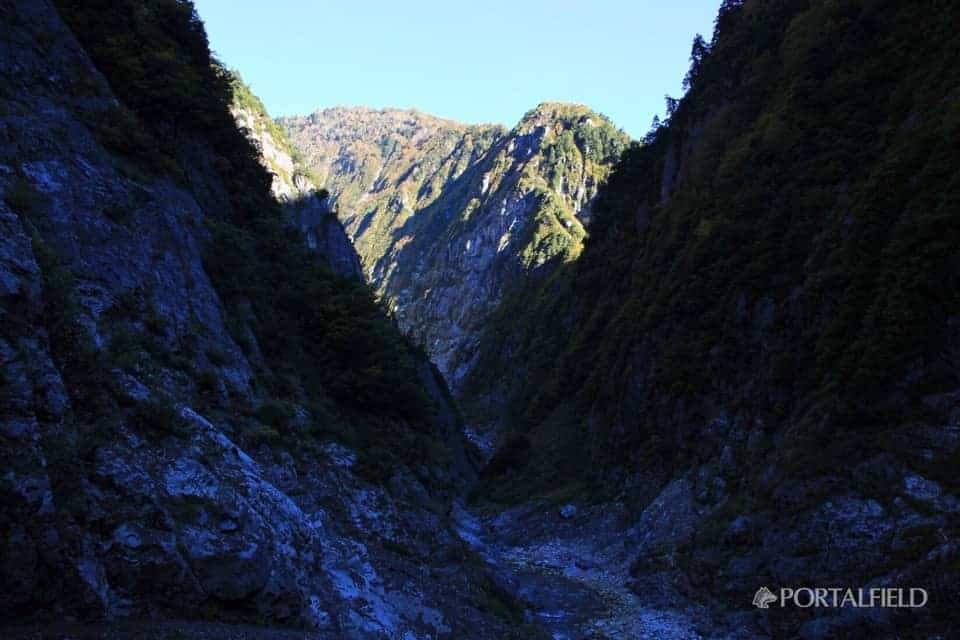
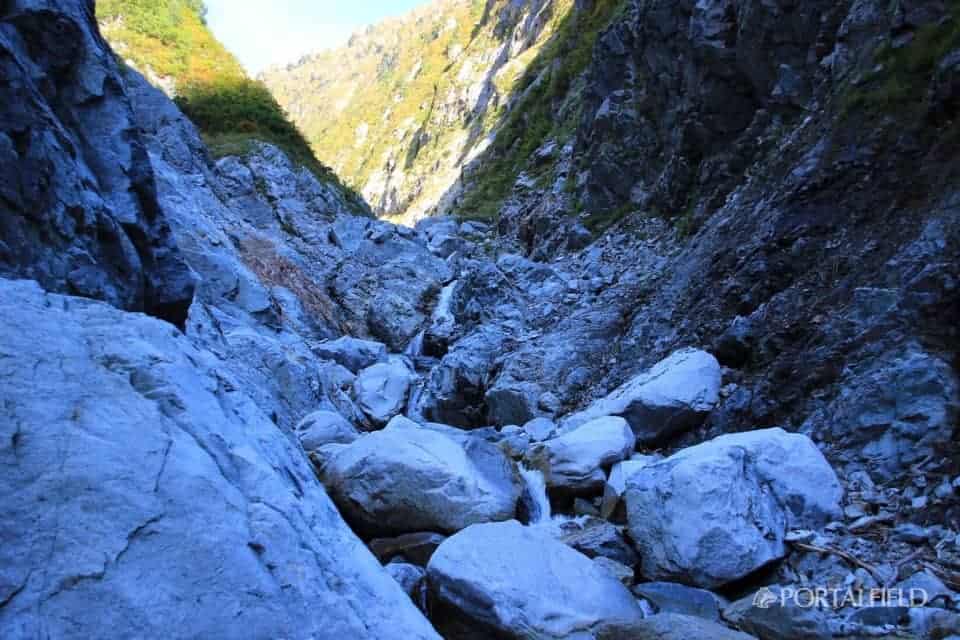
To the core of the lower corridor
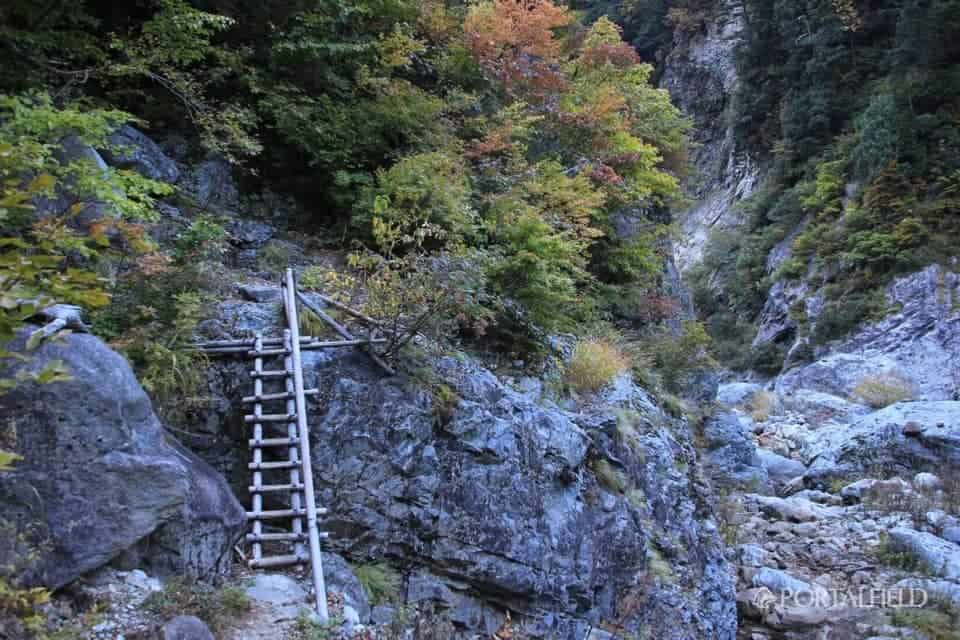
Pause at the built-in aid valley junction, across the flow from built-in aid valley, the next pointIdeyama TaniDepart for. You can see the ladder a little while ahead.
Walking about 10 minutes will start the galley field.
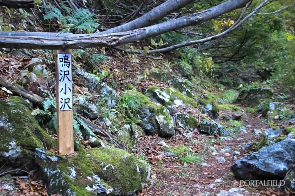
It is about 50 minutes from the built-inNarusawa OzawaWhat.
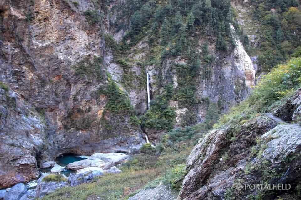
I'm suddenly here hanging out like this, but when I was walking I do not know what kind of point it is.
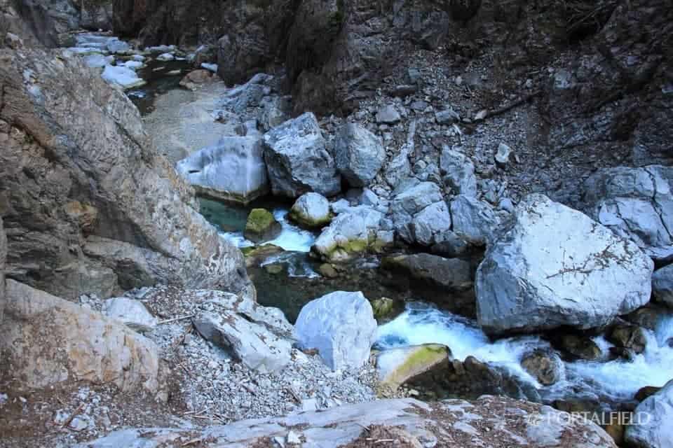
Later, if you take a closer look at the "Yama-To-Kogen-Chizu" map, you will see the area around this "Narusawa OzawaThere is a stream that says "Name waterfallとNameless waterfallOne 2 was listed. I just saw a waterfall from around here, so it may be either a waterfall of Name or a waterfall without that name.
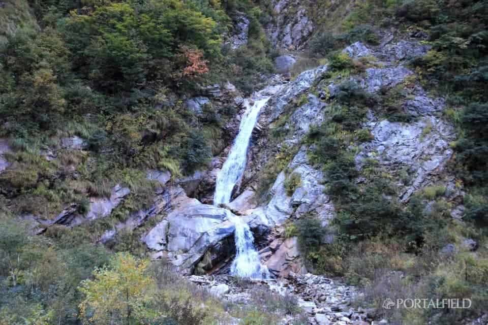
The lower picture is the lower part of the lower 3 section of the waterfall of the 2 section shown in the upper photo.
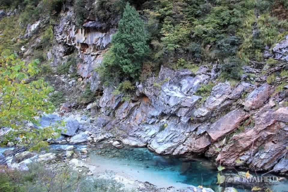
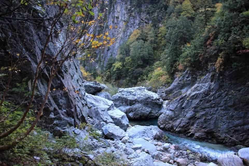
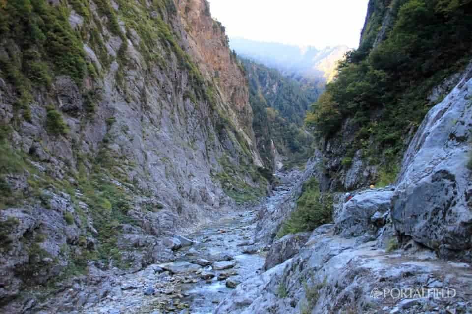
The color of Kurobe River is unique from this area. Is it a change of light?
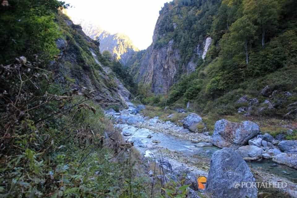
There is a tent on the riverside. And even 2. It should not be a tent permit area, but more than that, I wonder if it is not scary when I think about the possibility of increasing the water volume at once in such a place. There is also the possibility of an emergency water discharge from the dam, and in fact, it has begun to rain from the night of this day.
Or rather, when I wrote this, I rewrote the "Yama-To-Kogen-Chizu" map again and it was written firmly. This area is "Southeast Wall Kurobe's Genie"So yes"Kurobe Three Big Quay"And. "DangerIn red next to the mark "No act". It seems unusual for the idea to daring to run in such a place, but if you know it and it is running, it is a bit vicious.bivouacIt looks like nothing if it feels like it.
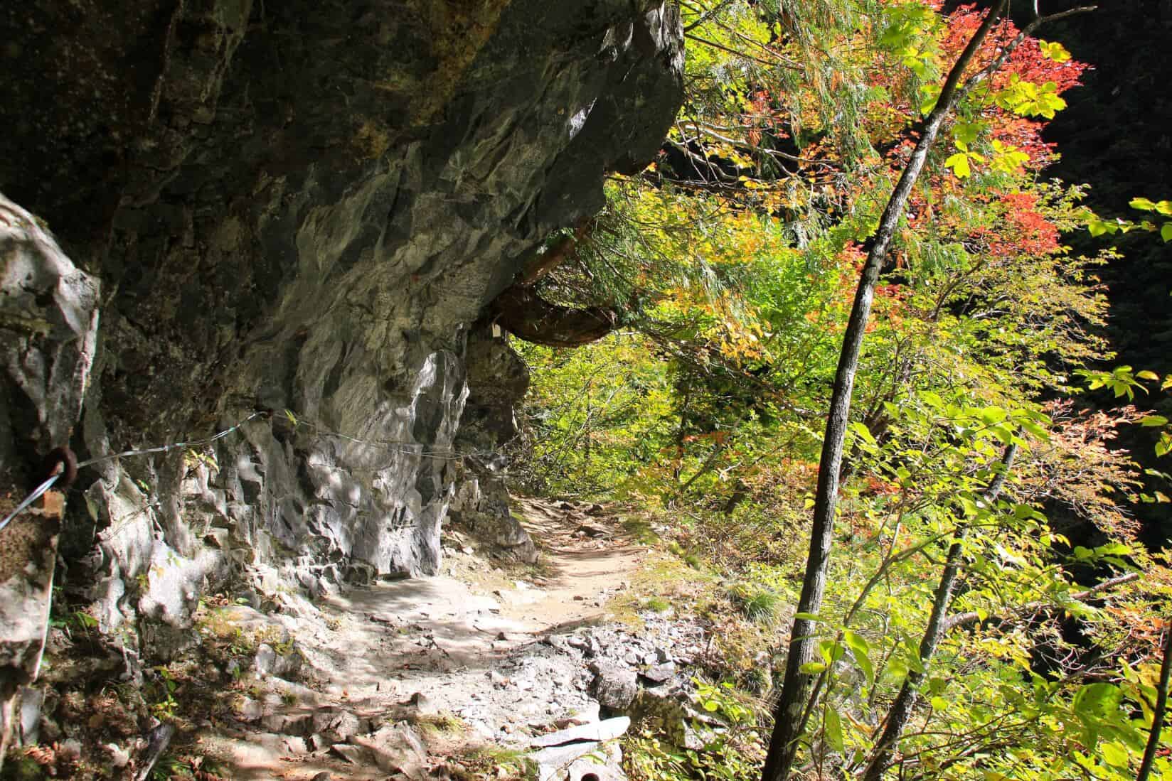
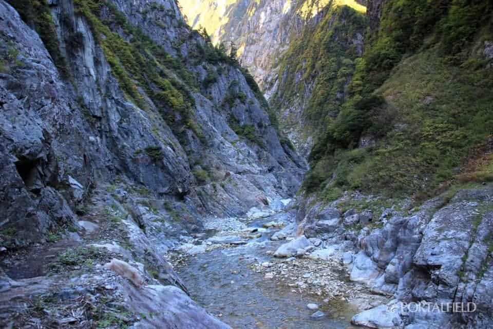
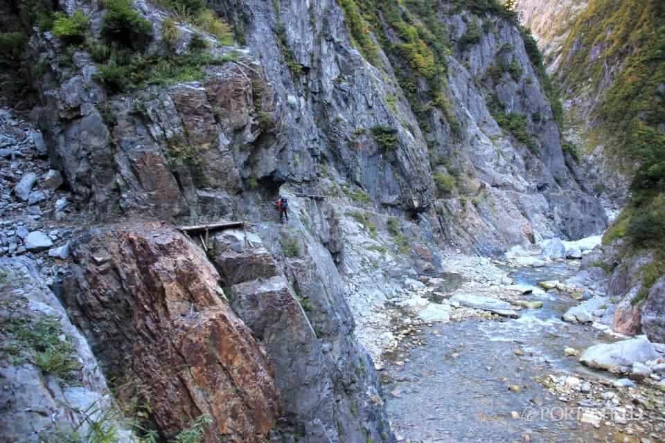
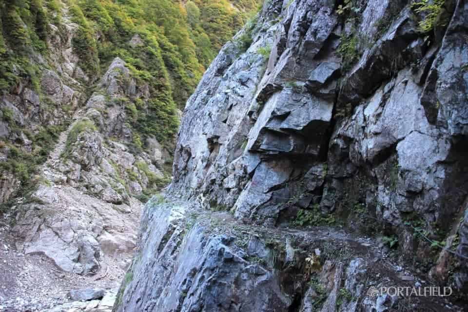
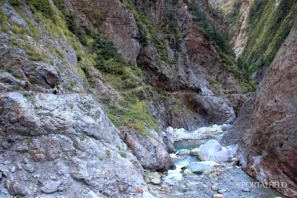
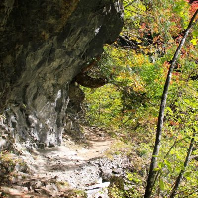
I came here! ReallyAn atmosphere like the lower corridorThe road of finally appeared. It is passing to the left of the foothold of the logLine.
Around here, there seems to be Iwana.
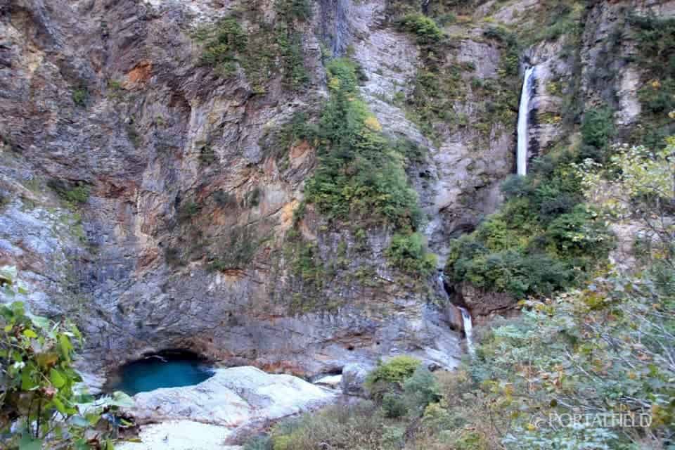
If you go further by 10 minutes, there will be a big waterfall on the opposite bank. The flow of the Kurobe River is also beautiful.
Walk a little and look back at the waterfall just before. The feeling of the road gradually gets steeper from here.
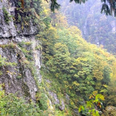
The scenery like the photograph of the lower corridor has expanded, which I have seen in the internet, magazines and route guides.
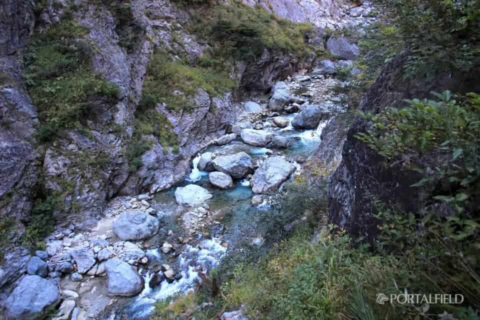
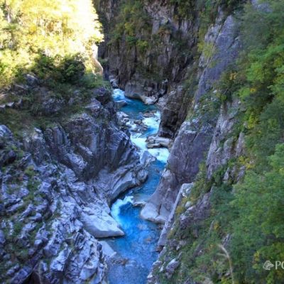
The flow of the Kurobe River at your feet. Whiteness has become noticeable whether the height difference has come out. Do you have a char.
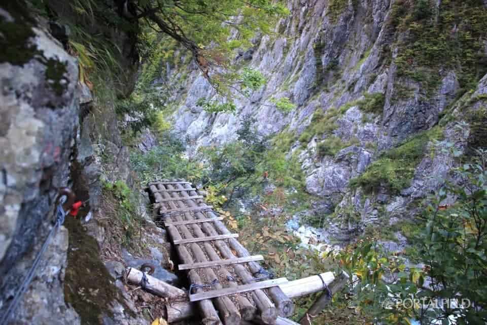
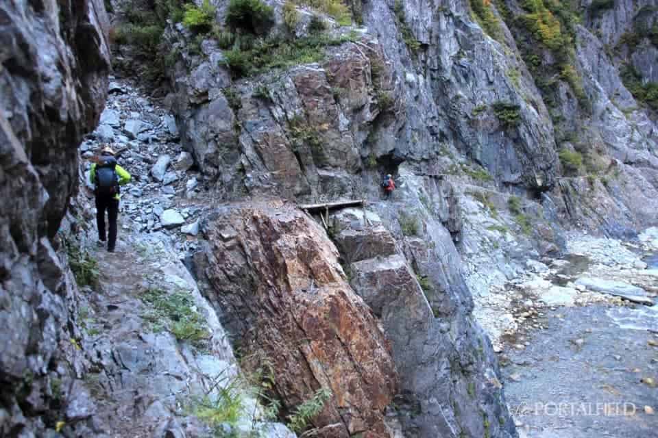
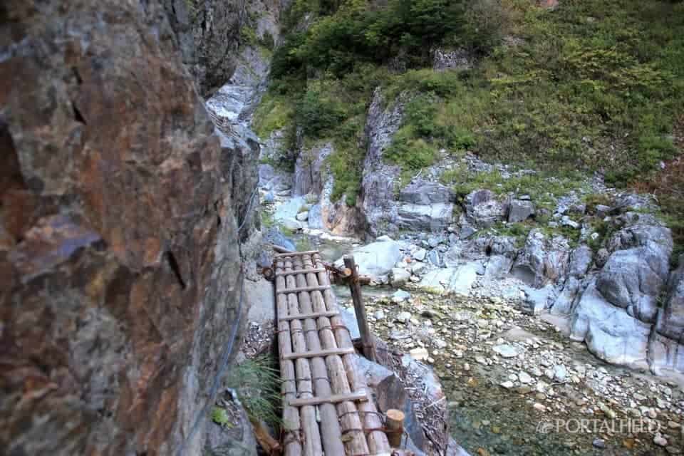
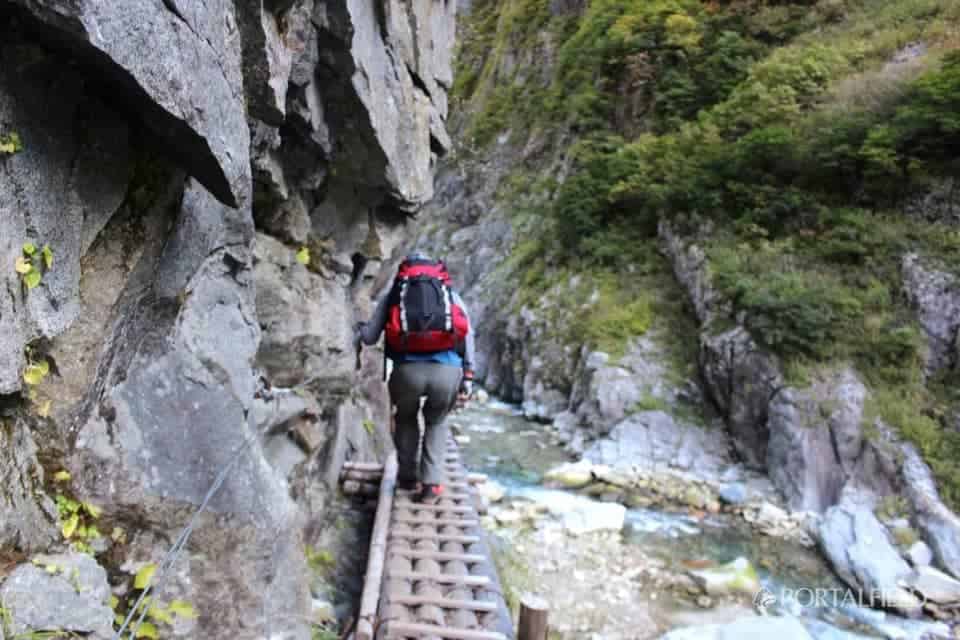
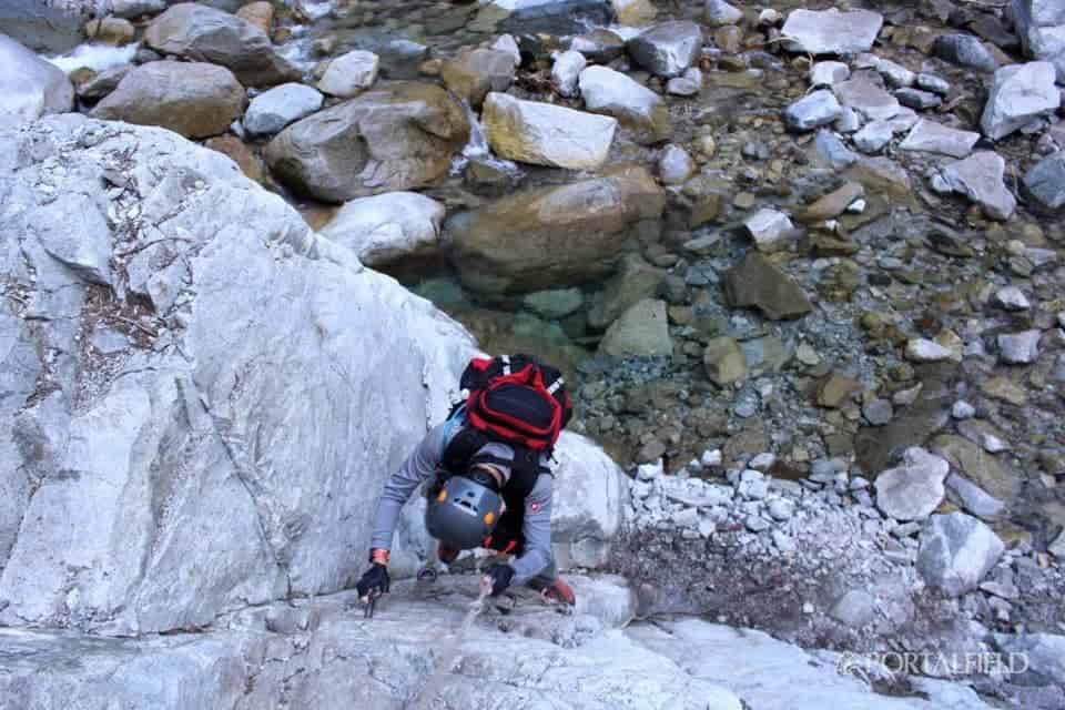
The way of taking a foothold was like this. Because it is firmly fixed, except for the damaged onesThere was almost no feeling of wobbleis. However, if you look at the picture well laterIt is fixed by quite sharp balanceThere was also one thing Chirahora (lol)
The morning sun was inserted to the middle of the mountain.
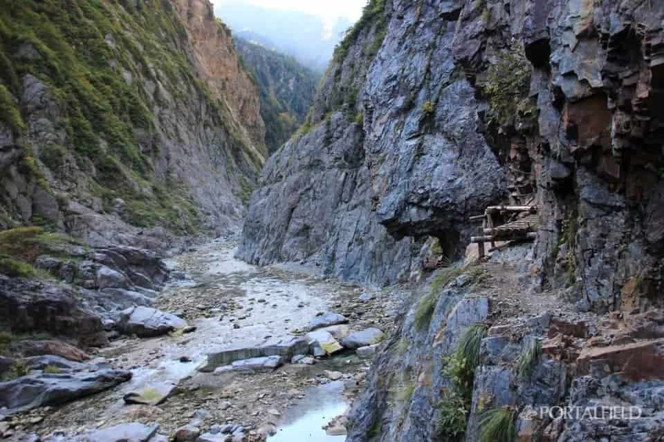
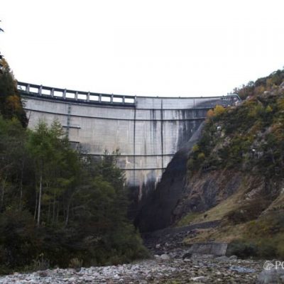
Looking up Kurobe River upstream, Kurobe Dam direction. It will be completely V-shaped valley in any time.
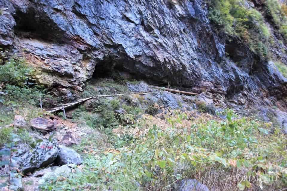
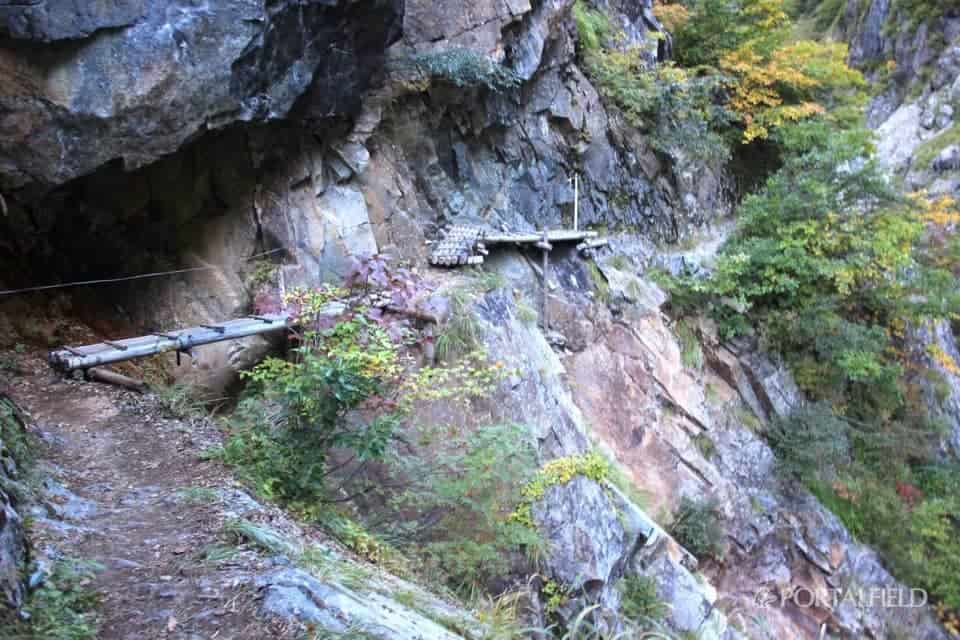
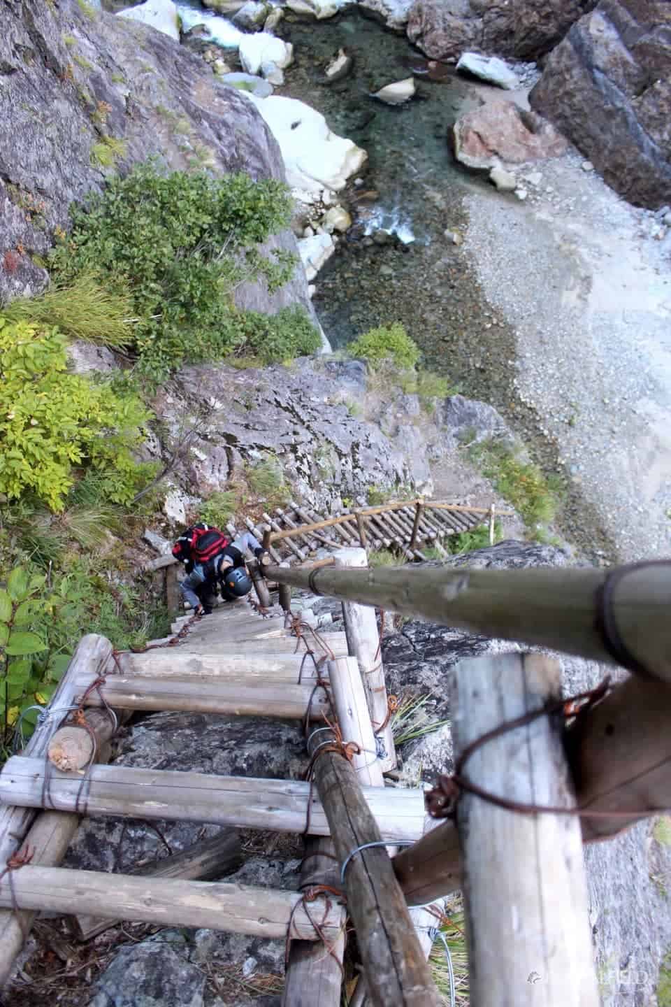
Just a little further in the direction of travel, we saw a few ladders for high-rolling the fallen part.
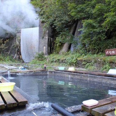
After this, the two who walked forward walked at almost the same pace until tomorrow's Jinpei.Azohara Onsen Goya(Onsen open-air bath ... lol), from KeyakidairaDolly train (Kurobe gorge railway)Thank you for having a nice time together.
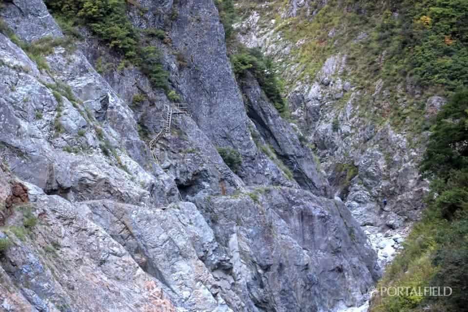
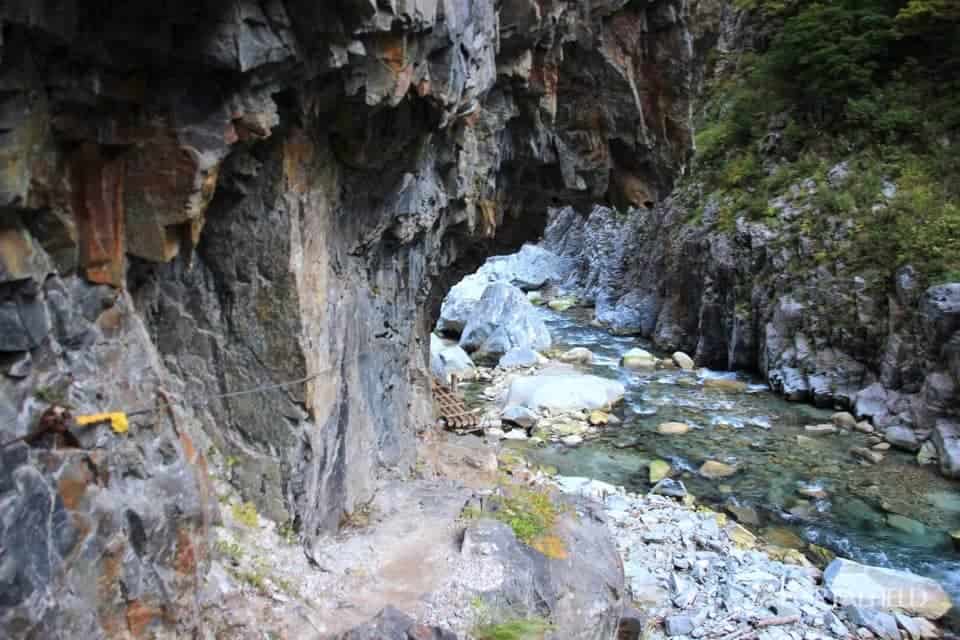
Finally we have seen an example ladder. There is a height that you think that you installed in a place where there is almost no foothold.
A narrow road comes out of this area.Slip down notice.
Depending on the location, taking pictures is quite desperate (laughs)
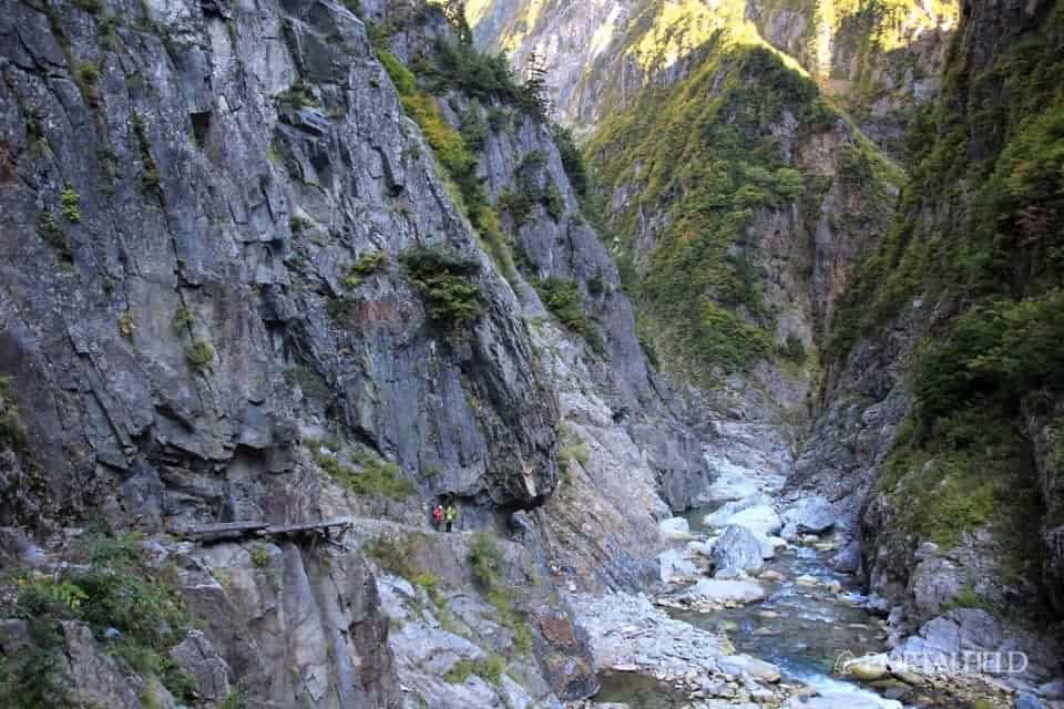
If you refer to the size of the person, whether it is easy to understand the feeling from the height of the water surface, comparing the depth of the valley.
The above is the picture I used on Twitter. In addition to your feet, there are places where you will hit your head if you are not careful.Helmet requiredis. It helped me a lot.
Walk a little and look back at the previous point. I do not feel that much when I am walking, but it is easy to understand the ups and downs of the road in the photos.
I feel like this. This time, I thought about how to take a picture when taking a picture. If you listen to the story of people who went to the lower corridor and look at the blog "I grabbed the line with one hand and took it with one hand"There is a lot of talk, but let's finish shooting in a short time & By taking it with one hand"There were many blurred photos due to camera shake"There seems to be a lot of patterns, and what should I do?
This mountain-row photo has been taken with a single-lens reflex camera, but it is quite heavy making it difficult to balance the camera even if I intend to shoot with one hand, and the blur is still in focus even when the shutter is released As it is easy to become a photograph, I am going to stop shooting with one handTo reopen and take normally.
This is one of the photos taken to the very limit of the normal shooting with both hands. As well as this place, I paid the utmost attention to shooting on the mountain,I feel a bit creepy now. Safely.
It is downhill of the ladder which I saw a little while ago. As we only partially roll high, when we climbI'm waiting for a ladder going down soon. The ladder is slightly bent on the way as shown in the photo. I was a little scared here when I was getting backwards.
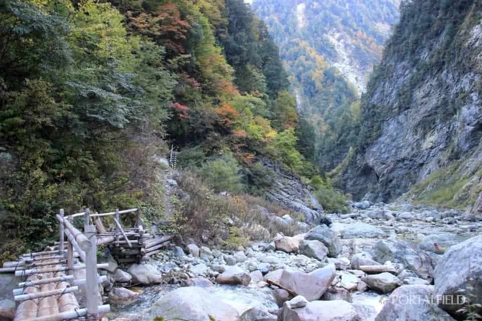
If you go down the ladder, you will return to the way like before. The route ahead will turn to the right, but the destination isIdeyama Tani.
How did you get off? I thought it was a piece I thought for a moment, but it was a place I could go if I walked down this road and walk along the riverside (laughs)
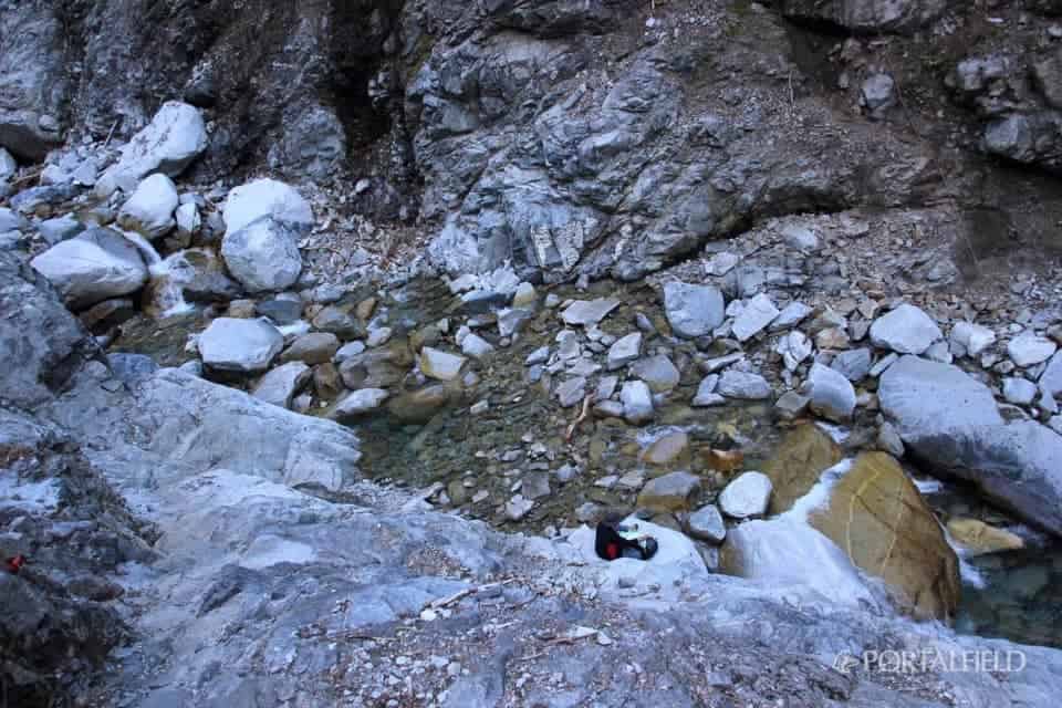
I went down the rocky place to Ideai, another mountain valley.
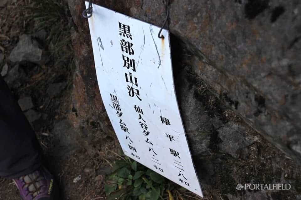
8: Around 45,Ideyama Tani(Kurobebetsu Yamatani)Arrival in. From built Ikutani I got 1 time 50 resolution.
At this point, the number of photos from morning has exceeded 160. It is a feeling that the number of photos has increased dramatically because the scenery has become a lower corridor since Ideai, built. In this section, I had a hard time organizing photos since I came back (laughs)
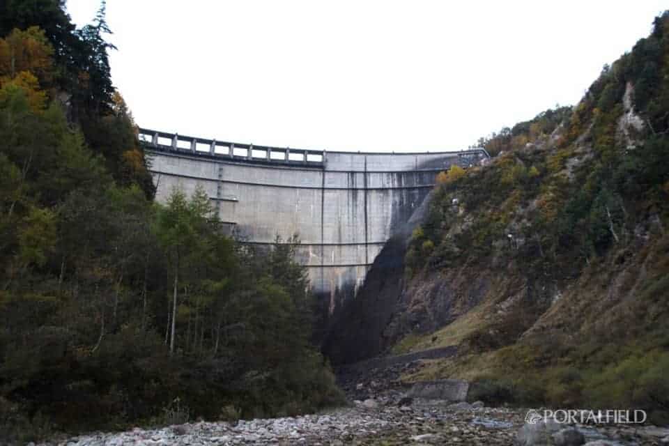
Azohara Onsen GoyaIs the tip of the Senninya Dam, so hereAt Idegai Tateyama, half of today's journey has not come yet. From Kurobe Dam Station to Kotohira Station30.2kmAfter all, it is a fine distance.

Related to this daymikketa(Mikke) ”mountain hut information and weather forecast
Azohara Onsen Goya
Lodge Kuroyon
This article was relocated to "PORTALFIELD" in 2016 month in 10 month. Some corrections have been made to relocate the article. (PORTALFIELD Takahashi)
Other articles of "2016 lower corridor, walk on the old Nichiden sidewalk"
2016 lower corridor, walking the old NDC footpath 10/15 edition Ogisawa → Kurobe dam → Lodge Kuroyon
2016 / 10 / 15 ~ 17 walk from the Shimono corridor, the old Niden walkway route, 1 day 10 / 15 access to Kurobe dam & lodge Kuroyon accommodation. Itinerary: Shinjuku → Shinano Omachi → Ogizawa → Kurobe Dam → Lodge Kuroyon. In 2016 this year, the Shimono Corridor opens! The Tateyama and Kurobe areas are basically areas where the Tateyama Kurobe Alpine Route is often used, More
From the lower corridor, which used to walk on the date of 2016 / 10 / 15 to 17, from the former Nichido trail route, from lodge Kuroyon of XNUM day 2 / 10 to Azohara Onsen Goya, lodge Kuroyon → built-in Sugaya Ide Hen. The travel map is here. On this day's journey, lodge Kuroyon → Kurobe Dam → Built-In Sotani Ide → Betsukan Valley Ide → Hakuryu Gorge → Cross Gorge → S-shaped Gorge → Senjin Valley Dam → Azohara Onsen Goya. More
From the lower corridor, which has walked on the date of 2016 / 10 / 15 to 17, from the old Nichido trail route, from lodge Kuroyon of the XNUM day 2 / 10 to Azohara Onsen Goya, another mountain valley Ide → Cross Gorge. The travel map is here. On this day's journey, lodge Kuroyon → Kurobe Dam → Built-In Sotani Ide → Betsukan Valley Ide → Hakuryu Gorge → Cross Gorge → S-shaped Gorge → Senjin Valley Dam → Azohara Onsen Goya. More
From the lower corridor, which has walked on the date of 2016 / 10 / 15 to 17, from the former Nippon Electric Trail route, from the lodge Kuroyon of the XNUM day 2 / 10 to the Azohara Onsen Goya, the Cross Gorge → S-shaped Gorge. The travel map is here. On this day's journey, lodge Kuroyon → Kurobe Dam → Built-In Sotani Ide → Betsukan Valley Ide → Hakuryu Gorge → Cross Gorge → S-shaped Gorge → Senjin Valley Dam → Azohara Onsen Goya. More
From the lower corridor in the 2016 / 10 / 15 to 17, from the old Nichido trail route, from the lodge Kuroyon of the XNUM day 2 / 10 to Azohara Onsen Goya, S-shaped → Senjindani Dam → Azohara Onsen Goya ed. The travel map is here. On this day's journey, lodge Kuroyon → Kurobe Dam → Built-In Sotani Ide → Betsukan Valley Ide → Hakuryu Gorge → Cross Gorge → S-shaped Gorge → Senjin Valley Dam → Azohara Onsen Goya. More
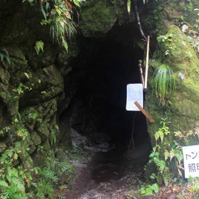
From the lower corridor, the old Nichido footpath, and the horizontal footpath route that I have walked on the date of 2016 / 10 / 15 to 17, from Azohara Onsen Goya on XNUM X day 3 / 10 Oriodani Sabo embankment tunnel → large drum edition. The travel map is here. The journey on this day is Azohara Onsen Goya → Oriodani Sabo embankment tunnel → large drum → Shiaitani tunnel → Kiritani → Kotohira → Unazuki → Unazuki → Toyama → Tokyo. More
From the lower corridor, the old Nichido footpath, and the horizontal footpath route that I have walked on the date of 2016 / 10 / 15 to 17, from Azohara Onsen Goya on XNUM X day 3 / 10 through Kotohira to the area of Unazuki Aiya Tunnel → Shinpei Hen. The travel map is here. The journey on this day is Azohara Onsen Goya → Oriodani Sabo embankment tunnel → large drum → Shiaitani tunnel → Kiritani → Kotohira → Unazuki → Unazuki → Toyama → Tokyo. More
From the lower corridor, the old Nichido footpath, and the horizontal footpath route that I have walked on the date of 2016 / 10 / 15 to 17, from Azohara Onsen Goya on XNUM X day 3 / 10 → Toyama edition. The travel map is here. The journey on this day is Azohara Onsen Goya → Oriodani → Daikoko → Shiaitani Tunnel → Ashiya → Kotohira → Unazuki → Toyama → Tokyo. Also includes the eating walk in Toyama. More